Toozaka Pass
| Toozaka Pass | |
|---|---|
 Toozaka tunnel tollgate | |
| Altitude | 380 [1] m |
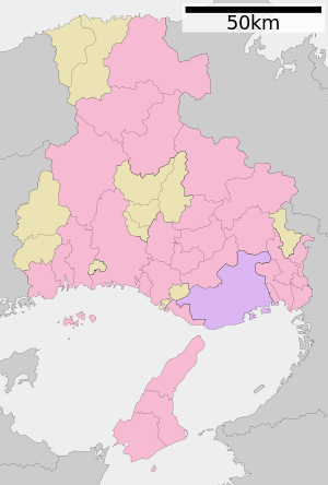
| The location | HyogoTanba-shi・Asago-shi |
| Mountain range | Tanba Highlands |
| The street that passes | North Kinki Toyooka Expressway (Toozaka tunnel) |
The Toozaka Pass (とおざかとうげ) a mountain pass [1] in the Hyogo middle northern district.
Table of contents
Geography
At the mountain pass in the saddle of the ridge lengthening northeast from the Mt. Awaga (962.3m), it is the center watershed with Kako River water system and the Maruyama River water system [2]. It becomes the border of Tanba country (Hikami) and the Tajima country (Asago-gun) in the past [1], and it is now in the city boundary of Tanba-shi and Asago-shi of Hyogo.
It was a passage place of Sanin Expressway at the time, and, according to "the Engi era type of the Heian era," there was a posting stage called "Awaga" (Santouchoawaga, Asago-shi) on "Saji" (now Aogakichosaji, Tanba-shi), the Tajima country side on the Tanba country side [1].
It is said that the "Saji" station was in Aogakichotoozaka of the east base of a mountain of the mountain pass. Toozaka is the best basin of Kakogawa [note 1], and the branch called the Toozaka river which parted from the main stream of Kakogawa forms a deep valley. This area was called Toozaka Valley, but when "Toozaka" (valley) pointed to the innermost mountain pass when I pointed to one body, I wrote it with "Toozaka" and was divided [1].
It is thought that the "Awaga" station would be in Santouchoshiba, Asago-shi that is the west foot of the mountain pass [4]. The present Awaga district is to approximately 1km west from 柴地区, and Awaga Shrine is enshrined [2]. This one becomes the source of branch Shibakawa of the Maruyama River [4].
Present condition
For material linking Tanba country and the Tajima country, there is Kuno Heights at night to approximately 5km north of the Toozaka Pass, and San'in Main Line and National highway No. 9 pass Kuno at night [5]. But there is the Kuno Heights at night in the point that sailed up Makigawa of the Yura River water system flowing into the Sea of Japan and is not center watershed [note 2]. (there is the watershed by this route in the Kannon Pass between Sonobe-cho and Fukuchiyama-shi.)
In contrast, the Toozaka Pass hit the upper reaches of the Kako River which knew the sea in Harima country and went by way of Harima country from Kyoto, or it was necessary to detour from Fukuchiyama (in this case I will go over the watershed three times).
It was modern times, and Hyogo prefectural road Shangdong Kashiwara Line came to go to the Toozaka Pass [1]. This route became one of the important areaways which linked 丹但 (old Tanba country, Tajima country), but snow was deep, and it was often impassableness in the winter season [1]. Toozaka tunnel was inaugurated by Hyogo road public corporation in 1977 (52, Showa) years, and the section of 4.7km before and after the mountain pass including a tunnel became the Toozaka Pass toll road. Traffic was in this way enabled in whole year of the Toozaka Pass [1].
It became National highway No. 427 1,982 years later and treated the overlap section with National highway No. 483 more in 1993. National highway No. 483 becomes the North Kinki Toyooka Expressway afterwards in 2006; the short circuit road via the Toozaka tunnel North Kinki Toyooka Expressway (National highway No. 483), the old mountain pass with National highway No. 427 treated it. In addition, the Toozaka tunnel becomes the paid section. (the details refer to Toozaka tunnel.)
Footnote
Explanatory note
- ^ is common, and the part of "Kakogawa" of upper reaches is called "Saji River", and the join of Saji river and the Sasayama River says the down stream side with "the Kako River". [1][3]
- The ^ Yaku field Heights lacked in water in the lava plateau where lava deposited on thickness of 85m, and the traffic was difficult although the way which a pilgrim went along knew it in the Middle Ages [5].
Source
- ^ a b c d e f g h i "Tsunogawa Japan place name Dictionary 28 Hyogo" p995 "Toozaka" "Toozaka Pass" "Toozaka Pass toll road"
- ^ a b "Tsunogawa Japan place name Dictionary 28 Hyogo" p122 "foxtail millet Kayama" "Awaga Station" "to congratulate a foxtail millet"
- ^ "Tsunogawa Japan place name Dictionary 28 Hyogo" p674-675 "Saji" "Saji River"
- ^ a b "Tsunogawa Japan place name Dictionary 28 Hyogo" p729 "柴"
- ^ a b "Tsunogawa Japan place name Dictionary 28 Hyogo" p1498-1499 "night Kuno" "night Kuno Heights"
References
- "Tsunogawa Japan place name Dictionary 28 Hyogo," it is Tsunogawa Japan place name Dictionary editing Committee, Rizo Takeuchi, 編, Kadokawa Shoten, 1988, ISBN 4-04-001280-1
Allied item
- At a mountain pass in the south, the southwest of the Mt. Ikino Pass - Awaga, it is the border of Harima country, the Tajima country.
- Asago mountain range Prefectural nature park
- List of Japanese mountain passes
This article is taken from the Japanese Wikipedia Toozaka Pass
This article is distributed by cc-by-sa or GFDL license in accordance with the provisions of Wikipedia.
In addition, Tranpedia is simply not responsible for any show is only by translating the writings of foreign licenses that are compatible with CC-BY-SA license information.
0 개의 댓글:
댓글 쓰기