S ten felt
| Crest | Map (position of the county) |
|---|---|
 | 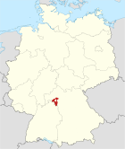 |
| Basic information | |
| Federal state: | State of Bayern |
| A precinct: | Yes, it is a terflanken precinct |
| A county: | ヴュルツブルク county |
| Latitude longitude: | 49°50'N 10°01'E |
| Altitude: | 246m above see level |
| An area: | 18.12 km² |
| Population: | 5,060 (as of December 31, 2015) [1] |
| Population density: | 279 /km² |
| A zip code: | 97230 |
| An area code: | 09305 |
| A number plate: | WÜ |
| Local government cord: | 09 6 79 130 |
| An address of the intendance: | Untere Ritterstr. 6 97230 Estenfeld |
| A website: | estenfeld.net |
| The mayor: | ロザリンデ シュラウト (Rosalinde Schraud) |
| Position in the county | |
 | |
As for the S ten felt (Estenfeld), State of Federal Republic of Germany Bayern is the headquarters location of the S ten felt administration community yes in the municipalities (I describe it in this clause for convenience as follows with "a town") of the ヴュルツブルク county of the terFranken district. This town located in the valley of the キュルナッハ river has the history more than it even from the first to go out in documents in the ground where a person lived in from the ancient times in 1100.
Table of contents
Geography
キュルナッハ river flows through the town of the S ten felt. A part becomes the culvert, but the building of the town is concentrated in the west of the キュルナッハ Valley. It is about these days that construction became popular on the opposite bank of the river. The old cityscape opened to the northeast. The direction of the wind and the break in the weather change mainly from the west. It is rare that rain and a storm come from the east. As for the local person, it is said that the forthcoming storm is severe from the east.
Constitution of the local government
This town is formal; consisting of three district (Ort) [2]. Of these, I list below a small village and the villages except isolated farms.
- S ten felt
- Mule how then
History
The domain of this town has already become the permanent home for the Stone Age. The S ten felt is recorded for documents for the first time as "Espinaveld" for 844 years. At first the S ten felt was made common customs as a part of the ヴュルツブルク bishop territory in 1803 by Bayern archduchy. I was moved by the ヴュルツブルク grand duke country founded based on agreement of reconciliation (1805) of Pressburg by the Tuscany grand duke Ferdinand third, but finally became the Bayern kingdom territory afterwards in 1814. By cities, towns and villages law of 1818 with the administrative reform of Bayern, the current local government was formed.
Religion
The S ten felt has Catholicism and a Protestant church organization. The patron saint of the town is Saint マウリティウス, and the Catholic Church is named for this saint. A Jew lived in the S ten felt until the times of the National Socialism. A monument was built in the open space of the old synagogue trace by Jewish people.
Merger of towns and villages
Mule how then merged with S ten felt voluntarily in 1978.
Administrative
Three political group occupies a seat for a town assembly to S ten felt as of 2008. The town assembly consists of 16 members of the Diet, and the mayor joins this.
Sister city
 ユオドゥペ、オベレイ、Bread Delhi(Lithuania、パネヴェジース county)
 - Each these three towns belongs to the パネヴェジース county ロキシュキス district local government and is located around tn. ロキシュキス.
Economy and social capital
Traffic
The S ten felt is located along the federal autobahn A7 line (ヴュルツブルク / S ten felt interchange) and federal way B19 line. These detour around a town of S ten felt and キュルナッハ and run. The B19 line ran in the downtown of the S ten felt until 1986.
Quotation
Outside link
This article is taken from the Japanese Wikipedia S ten felt
This article is distributed by cc-by-sa or GFDL license in accordance with the provisions of Wikipedia.
In addition, Tranpedia is simply not responsible for any show is only by translating the writings of foreign licenses that are compatible with CC-BY-SA license information.
0 개의 댓글:
댓글 쓰기