Kamihosoimachi
| Kamihosoimachi | |
|---|---|
| — 町丁 — | |
| Maebashi City Maehashi Senior High School | |
| | |
| A coordinate: 36°25'20" N 139°4'33" E / 36.42222 degrees N 139.07583 degrees E | |
| Country | |
| The metropolis and districts | |
| Cities, towns and villages | |
| Area | |
| - 計 | 2.51km2 (1mi2) |
| Population [1] | |
| - 計 | 2,697 people |
| - Population density | 1,074.5 /km² (2,782.9 /mi²) |
| Equal time obi | JST (UTC +9) |
| Zip code | 371-0051 |
| Number plate | Maebashi |
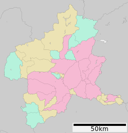
Kamihosoimachi (the town which chews, and is narrow) is the place name of Maebashi-shi, Gunma. The zip code 371-0051 [2]. The area as of 2013 is 2.51km2[3].
Table of contents
Geography
There is Fujimi district in the north side.
History
| The correction of this knob is expected. |
Education
In the elementary school, Maebashi City Hosoi Elementary School, junior high school are appointed in the school district of the Maebashi City Kamakura junior high school [4].
Traffic
Railroad
There is not the railroad station.
Bus
| The correction of this knob is expected. |
Road
In the national highway, Gunma prefectural road 4 Akagi, Maebashi Line and Gunma prefectural road 76 Maebashi Nishikubo line go along National highway No. 17 Jobu road, the prefectural road.
Facilities
- Maebashi City Maehashi Senior High School
- Maebashi City Kamakura junior high school
- Maebashi-shi firefighting station north fire department
- Maebashi citizen pool
- Maebashi City Hosoi nursery school
Source
- ^ "As of Basic Resident Register March 31, 2016". Maebashi-shi. May 2, 2015 reading.
- The ^ "zip code of Kamihosoimachi." Mail in Japan. May 2, 2016 reading.
- ^ Chapter 2 population - Maebashi-shi May 02, 2016 reading.
- The ^ "Maebashi City Elementary School and rule about the school district of the junior high school." Maebashi-shi. May 2, 2016 reading.
This article is taken from the Japanese Wikipedia Kamihosoimachi
This article is distributed by cc-by-sa or GFDL license in accordance with the provisions of Wikipedia.
In addition, Tranpedia is simply not responsible for any show is only by translating the writings of foreign licenses that are compatible with CC-BY-SA license information.


0 개의 댓글:
댓글 쓰기