Hirakata-shi
| ひらかたし Hirakata-shi | |||
|---|---|---|---|
 ひらかた park Ferris wheel | |||
| |||
| Country | |||
| District | The Kinki district | ||
| The metropolis and districts | Osaka | ||
| Group cord | 27,210-8 | ||
| Area | 65.12km2 | ||
| Total population | 402,719 people (population, June 1, 2016 by estimate) | ||
| Population density | 6,180 /km2 | ||
| The adjacent local government | Neyagawa-shi、Katano-shi、Takatsuki-shi、Mishima-gunShimamoto-cho Kyoto: Kyotanabe-shi, Yawata-shi Ikoma-shi, Nara | ||
| Tree of city | Willow | ||
| The queen of the city | Chrysanthemum, cherry tree | ||
| Bird of the city | Kingfisher | ||
| Hirakata-shi government office | |||
| The location | 〒573-8666 2-1-20, Ogaitocho, Hirakata-shi, Osaka A 34°48'N 51.7 seconds 135°39'E 2.3 seconds coordinate: 34°48'N 51.7 seconds 135°39'E 2.3 seconds 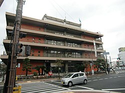 | ||
| Outside link | Hirakata-shi | ||
|
■ - Ordinance-designated city / ■ - city / ■ - town, village | |||
| Important Notice | The number of the households: 176,715 (January 31, 2016) The tree of city is established a queen "chrysanthemum" of the city in 1967 The bird of the city establishes the queen "cherry tree" of the city an establishment in 2007 in 2002 | ||
| Wiki project | |||


The city where Hirakata-shi (ひらかたし) is located in the Kitakawachi, Osaka area. I speak the Hirakata town (ひらかたちょう) which is a name before the municipal organization in this clause.
It is located in the prefectures boundary with Kyoto, Nara. I shifted to the core city on April 1, 2014. It was a post town of the Kyokaido Road, and the county government office in Kitagawa ever developed as a local core city in employed Kitagawa, too. Star Festival legend やひらかた park, there are six universities, championship school of the national high school rugby meet, stronghold of volleyball V league Panasonic Panthers again.
The western part of city linked Keihan Electric Railway Keihan Main Line, the eastern part of city to Kyobashi, Kitashinchi, Amagasaki by JR Tozai Line, and, in the inner-city, National highway No. 1 ran, and the newly second Keihan road was inaugurated in the eastern part of city.
Table of contents
Geography
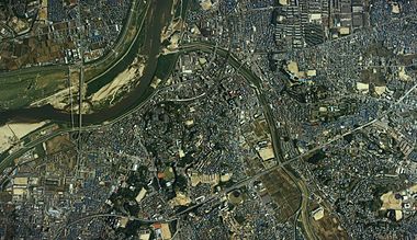
Hirakata-shi of Osaka-shi and Kyoto-shi is almost located in the Yodogawa left bank of approximately 20km towards Kyoto-shi from Northeast Osaka, Osaka-shi equal to the middle. East-West 12.0km, a triangle of north and south 8.7km take shape, and the area becomes 65.12km².
I am surrounded by east Ikoma Mountains and Yodogawa spreading in the west, and, in the east side of the city, the west becomes at the east end of the north of Osaka plains from a mountainous district reaching Ikoma Mountains, the center of the city.
Topography
The topography of the city is greatly divided into four by altitude. The department of the city at the east end becomes the mountainous district districts more than 100m above sea level, and a mountain range ranges in Ikoma Mountains. The west of the mountainous district district becomes the foot of a mountain district of 50m - 100m above sea level, and Nagao hill spreads out. The west of the foot of a mountain district becomes the hill district of 20m - 50m above sea level, and east Hirakata plateau and west Kaori hill spread out across the Amano River. Most of the city limits are this hill district. The neighborhood of the river flowing into Yodogawa and Yodogawa becomes the Yodogawa low land districts less than 20m above sea level, and the flood plain of the river opens.
It is, and, in the stratum of the hill district, the fossils such as Japanese deer are found from the second marine deposit among a glacial epoch and the strata called the Osaka formation that I deposited in an interglacial period repeated during tens of thousands of years ago for approximately 2 million years in Orient elephant and old days by stratum and the class equal to the seventh marine deposit of several kinds of volcanic ashes.
Most of rivers flowing through the city are started from east Ikoma Mountains. Ship Hashikawa who is the first-grade river, ear Tanikawa, the Amano River are parallel equally from Ikoma Mountains, and the west cruises in the city and flows into the Gulf of Osaka after having joined Yodogawa.
There is an active fault zone called the Ikoma fault zone in Ikoma Mountains and the neighborhood of border of Osaka plains, and the Taguchi dislocation included in the Ikoma fault zone, Katano dislocation, Hirakata dislocation run through the city to the north and south. After having grown in south-southeast from steep mountain mountainous district west relationship in northern city, the Taguchi dislocation bends it in south-southwest. In the Katano dislocation, the Hirakata dislocation lengthens from Kaori hill west relationship by the west relationship of Ikoma Mountains south again to the north and south, and Katano dislocation and the Hirakata dislocation range each in the Ikoma dislocation near Shijonawate-shi.
Climate
I belong to the Seto Inland Sea-type climatic region, and it is relatively warm, and there is little precipitation. In addition, air heated under the influence of heat island effect near Osaka-shi flows in to sea breeze from the coast of Gulf of Osaka in the summer and of Mount Ikoma origin is blocked near Hirakata-shi. Therefore temperature tends to rise than the Osaka city and may record the highest temperature in the country. There is not most of the winter snow. The 1980s was / year for 40-80 hours, but, as for the time more than 33 degrees Celsius, is before and after it in / year for 150 hours from the late 1990s.
Annual precipitation 1,062mm, precipitation 172mm maximum on a day, mean temperature 16.2 degrees Celsius, highest temperature 38.3 degrees Celsius, minimum temperature -2.9 degrees Celsius (2001)
- Temperature - a maximum of 39.6 degrees Celsius (on 1994 (1994) August 8 1994 (1994) August 7), at least -7.1 degrees Celsius (1981 (1981) February 27)
- -172 millimeters of maximum precipitation (on 1999 (1999) August 11 2013 (2013) September 15)
- -21.5 meters of maximum instantaneous wind speed (2009 (2009) October 8)
- Days -155 days most in a summer day (2013 (2013))
- Days -96 days most on a tropical day (2013 (2013))
- Days -37 days most on a scorching hot day (2010 (2010))
- Days -43 days most at a tropical night (2010 (2010))
- Winter sunshine most days -86 days (1984 (1984))
| Climate of Hirakata | |||||||||||||
|---|---|---|---|---|---|---|---|---|---|---|---|---|---|
| Month | January | February | March | April | May | June | July | August | September | October | November | December | Year |
| Highest temperature record ° C (° F) | 17.5 (63.5) | 22.7 (72.9) | 25.1 (77.2) | 31.0 (87.8) | 33.2 (91.8) | 36.3 (97.3) | 38.2 (100.8) | 39.6 (103.3) | 36.8 (98.2) | 32.3 (90.1) | 26.7 (80.1) | 21.6 (70.9) | 39.6 (103.3) |
| Mean highest temperature ° C (° F) | 8.8 (47.8) | 9.6 (49.3) | 13.3 (55.9) | 19.7 (67.5) | 24.4 (75.9) | 27.7 (81.9) | 31.4 (88.5) | 33.2 (91.8) | 28.8 (83.8) | 22.8 (73) | 16.9 (62.4) | 11.6 (52.9) | 20.68 (69.22) |
| Mean minimum temperature ° C (° F) | 0.5 (32.9) | 0.8 (33.4) | 3.6 (38.5) | 8.7 (47.7) | 13.7 (56.7) | 18.5 (65.3) | 22.8 (73) | 23.7 (74.7) | 19.9 (67.8) | 13.3 (55.9) | 7.5 (45.5) | 2.7 (36.9) | 11.31 (52.36) |
| Minimum temperature record ° C (° F) | −6.2 (20.8) | −7.1 (19.2) | −4.4 (24.1) | −1.1 (30) | 3.2 (37.8) | 9.0 (48.2) | 15.3 (59.5) | 16.4 (61.5) | 9.4 (48.9) | 3.1 (37.6) | −0.6 (30.9) | −3.9 (25) | −7.1 (19.2) |
| Precipitation mm (inch) | 47.1 (1.854) | 64.1 (2.524) | 111.1 (4.374) | 102.9 (4.051) | 148.9 (5.862) | 195.5 (7.697) | 174.8 (6.882) | 118.0 (4.646) | 163.1 (6.421) | 115.9 (4.563) | 68.6 (2.701) | 43.0 (1.693) | 1,353 (53.268) |
| The mean rainfall days (≥1.0 mm) | 5.8 | 6.6 | 10.4 | 9.8 | 10.5 | 12.1 | 11.6 | 8.0 | 10.4 | 8.4 | 6.6 | 5.8 | 106 |
| The mean monthly daylight hours | 123.2 | 120.5 | 152.8 | 180.1 | 181.8 | 139.4 | 160.6 | 202.6 | 153.3 | 156.0 | 139.1 | 134.1 | 1,843.5 |
| The source: The Meteorological Agency | |||||||||||||
History
The place name of Hirakata is old and appears to a description of folk history, the Chronicles of Japan, the topographical record which are documents of the Japanese oldest grade.
Ancient - early modern times
- The Emperor Keitai succeeds to the throne (the old calendar) (the Emperor Keitai first year) in Kuzuha shrine (as for the waste a chisel) on February 4 for 507 years.
- I emigrate to cold dry wind blowing down from a mountain country (やましろのくに) pipe castle shrine (nudge a chisel) (current Kyotanabe-shi) (Emperor Keitai six years) for 512 years.
- 530 years (Emperor Keitai 24 years) in the Chronicles of Japan Hirakata as ratio 攞 哿駄 (ひらかた) the first to go out.
- I erect the Kudara temple (Tenbyoshoho era two years) for 750 years.
- Tsurayuki Kino writes down the House of the beach with "Tosa diary" (pax five years) for 935 years.
- I have the place name called the Imperial forest that Katano ヶ Hara becomes the noble drag hunt place (Jiryaku era three years) in 1067, and means a preserve [1].
- 蓮如 builds Kozenji at the exit (civilization seven years) in 1475.
- Masanobu Tsuda builds Tsuda Castle (Entoku two years) in 1490.
- 蓮如末子実従 becomes an order interest temple chief priest (Eiroku era two years) in 1559 and after that develops as a tradesman's town near a temple [2].
- Bunroku bank is done (Bunroku three years) in the Yodogawa left bank in 1594.
- Okashinmachi, 岡, Mitsuya, a mud town are considered to be Hirakata hotel (Keicho era six years) by the Shogunate in 1601.
- Nagao encampment is established by direct feudatory of a shogun Kugai (くがい) him (Genroku era two years) in 1689.
- Ten sides building 19 does not eat a passenger boat by "a foot journey out of Tokaido" (Kyowa era two years) in 1802 or draws a ship.
- Siebold writes down Hirakata in the account of a trip (civil administration nine years) in 1826.
Modern - prewar days
- I am admitted into the Kawachi prefecture (1869) in 1869. Kawachi prefecture is merged by the Sakai prefecture.
- A postal handling place is done (1871) in Hirakata in 1871.
- The eighth ward volost Elementary School (現蹉 跎 Elementary School) founds a school (1872) in 1872.
- The eighth ward volost Elementary School branch office (existing Hirakata Elementary School) founds a school (1873) in 1873.
- I am admitted into Osaka (1881) from the Sakai prefecture in 1881.
- Tsuda can do a postal handling place (1882) in 1882.
- A telephone is inaugurated (1890) in 1890.
- The army Imperial forest powder magazine is completed (1896) in 1896.
- Kansai railroad (existing JR Katamachi Line) is inaugurated (1898) on April 12 in 1898. Both Tsuda Station, Nagao Station stations start business.
- Army Imperial forest powder magazine explodes (1909) on the early morning of August 20 in 1909.
- Keihan train Keihan Main Line is inaugurated (1910) on April 15 in 1910. Kuzuha Station, Makino Station, Hirakata east exit Station (existing Hirakatashi Station), Hirakata Station (existing Hirakata-Koen Station), each station of Kozenji Station are made.
- A chrysanthemum figure exhibition moves (1912) from Neyagawa-shi in 1912.
- Private modern industry (1916) Hirakata's first for 1,916 years, the Nippon Medias (Kurabo Industries Hirakata factory in the back) opening of business Co., Ltd.
- Choya Shirts factory (existing Choya) Hirakata factory Co., Ltd. starts a business (1921) in 1921.
- Medical college (existing Kansai Medical University college of general education), Osaka dentistry technical school (existing Osaka Dental University) move to Osaka girls' high schools (1928) in 1928 and found a school (Keihan Electric Railway contributes a school land).
- Nobutaka Ikoma Railway Corporation Hirakata Line (existing Keihan Katano Line) is inaugurated (1929) on July 10 in 1929.
- Ohashi, Hirakata is inaugurated (former) (1930) on October 10 in 1930.
- National highway No. 2 Keihan national highway (existing prefecture way Moriguchi, Kyoto Line) is inaugurated (1933) (former) in 1933.
- I establish army arms factory Osaka arsenal Hirakata factory (1937) in 1937.
- Army Imperial forest powder magazine explodes very much (1939) on March 1 in 1939. Uji laboratory Kaori factory construction.
- Uji laboratory Kaori factory is established (1942) as Tokyo second army arms factory Kaori factory in 1942.
World War II post
- Municipal organization takes effect (1947) in the Osaka lower twelfth on August 1 in 1947. Hirakata-cho in Hirakata-shi. Area 40.62km², a population of 41,041 people.
- A municipal hospital opens a Diet session (1950) in 1950.
- Osaka army arms factory Hirakata factory (old army arms factory Osaka arsenal Hirakata factory) disposes, and it is decided (1952) in 1952 by Komatsu Ltd. Kudara temple trace special historic spot designation. Osaka Prefectural library Hirakata book station establishment, National highway No. 2 are renamed to National highway No. 1. Hirakata case outbreak.
- An honorific term for empress, for dowager empress, for grand-dowager empress first housing complex, the honorific term for empress, for dowager empress, for grand-dowager empress second housing complex are completed (1956) in 1956. It is started Kaori housing complex creation by Tokyo second army arms factory Kaori factory trace.
- Kaori housing complex entering starts (1958) in 1958.
- It is road safety city declaration (1962) for 1,962 years.
- National highway No. 170 establishes it (1963) in 1963 (April 1). The Hirakata Senior High School opening of a school. The Hirakata-shi Board of Education declares Hirakata thesis. Population surpasses 100,000 people.
- National highway No. 1 is inaugurated (中振 - 招提間) (1964) in 1964.
- Hirakata civic center is opened (1965) in 1965. Hirakata book station moves to civic center 3F as Hirakata-shi book center.
- The National highway No. 1 Hirakata bypass entire surface is inaugurated (1966) in 1966.
- It is established a city flag a tree of city "willow" a queen "chrysanthemum" of the city (1967) in 1967.
- Ohashi, Hirakata is inaugurated (1968) (newly) in 1968.
- National highway No. 307 establishes it (1970) in 1970 (April 1). Field service center establishment. The Hirakata Junior High School opening of a school. Population surpasses 200,000 people.
- I establish Hirakata citizens' charter (1971) in 1971. Mental health city declaration. Civic center coliseum completion.
- The waste is the lacing braid street opening of business (1972) in front of Kuzuha Station for 1,972 years.
- Hirakata municipal library starts (1973) in 1973. A car library "ひなぎく" service start.
- Nakamura-shi (Kochi, existing 40,010) friendship town cooperates (1974) in 1974.
- The ひらかた sun plaza building is completed (1975) in 1975. Violence exclusion city declaration.
- Population surpasses 300,000 people (1976) in 1976. I do not drink it or hold a fireworks display in the summer (until the summer of 2003).
- I establish Japanese National Railways Katamachi Line Fujisaka Station (1979) in 1979.
- The Keihan train handicap stone derailment by first junior high school student five (1980) Hirakata City for 1,980 years on February 20.
- National highway No. 168 extends (1982) to Hirakata-shi in 1982 (April 1). Nuclearfree peaceful city declaration。
- A general gymnasium is opened (1983) in 1983.
- I establish the Hirakata eight beauty spots (1984) in 1984.
- Betsukai-cho (Hokkaido), Shioe-cho (Kagawa, existing Takamatsu-shi), upper mirage Changning District (the People's Republic of China) friendship town cooperate (1987) in 1987.
- I establish it (1989) on a day of the peace in 1989. Keihan cable television (existing Kay cat) broadcast launch.
- Okamoto-cho redevelopment building "ビオルネ" is completed (1990) in 1990. Land sports stadium establishment.
- 啓光学園高校 wins the championship at the 71st whole country Senior High School rugby meet for the first time (1992) in 1992. Hirakata-shi aged society charter establishment.
- It is respect for human rights city declaration (1993) for 1,993 years. It is completed Hirakatashi Station high shelf.
- Welfare promotion city declaration (1994) healthy 1994.
- Logan city (Australia) friendship town cooperates (1995) in 1995. Population surpasses 400,000 people.
- The ひらかた park remodeling is completed (1996) in 1996. Kurabo Industries Hirakata factory moves to Tokushima-shi.
- Nago-shi (Okinawa) friendship town cooperates (1997) in 1997. FM ひらかた opening of an office.
- 啓光学園高校 wins the championship at the 78th whole country Senior High School rugby meet (1999) in 1999. Otaki-mura (Hokkaido, existing Date-shi), Tenkawa-mura (Nara), Hasami-cho (Nagasaki) citizen interchange city declaration. Little League team Hirakata little wins the championship at little league world meeting.
- Command star Senior High School attached to Tokai University wins the championship at the 79th whole country Senior High School rugby meet for the first time (2000) in 2000
- Special city shifts (2001) in 2001.
- 啓光学園高校 wins the championship at the 81st whole country Senior High School rugby meet (2002) in 2002. A bird "kingfisher" establishment of the city.
- 啓光学園高校 wins consecutively 2 in the 82nd whole country Senior High School rugby meet (2003) in 2003. The second Keihan road part opening to traffic, Hirakata east IC beginning to use. A limited express stops at Hirakatashi Station, Kuzuha Station daylong and starts (weekdays day time, the Saturdays and holidays whole day).
- 啓光学園高校 wins consecutively 3 in the 83rd whole country Senior High School rugby meet (2004) in 2004. Choya Hirakata factory moves to Higashiosaka-shi.
- 啓光学園高校 wins consecutively 4 in the 84th whole country Senior High School rugby meet (2005) in 2005. Lacing braid-cho redecorates the waste into KUZUHA MALL entirely. It is opened the life study and local interchange facilities "brightness plaza mica" "center library" by Kansai University of Foreign Studies single pike school building trace. A ひらかた size chrysanthemum figure exhibition end.
- Hirakata Hospital attached to Kansai Medical University opens a Diet session to Kurabo Industries Hirakata factory trace (2006) in 2006. Central library city station square satellite. Championship together first in the 28th whole country selection Senior High School tennis meet man and woman long Odani Senior High School.
- Command star Senior High School attached to Tokai University is championship of the way of 7 meet second in the 86th whole country Senior High School rugby meet (2007) for 2,007 years. A flower "cherry tree" establishment of February 9 City. Long Odani Senior High School wins consecutively game with group girl 2 in the 29th whole country selection Senior High School tennis meet. Mayor Hiroshi Nakatsuka falls out of employment by a collusion scandal on arrest, September 10 on July 31.
- Soul rock county (Republic of Korea Jeollanam-do) friendship town cooperates (2008) in 2008.
- The Keihan road opening to traffic (2010) second for 2,010 years.
- Core city shifts (2014) on April 1 in 2014.
Change of the governorate
- Hirakata town is a start by the enforcement of April 1 - municipality organization (1889) with an area of thorn field county Hirakata village, Mitsuya village, mud municipalities, Italy Kaga village, Okamura, Okashinmachi-mura for 1,889 years.
- Position county of the - thorn field county Hirakata-cho is changed to the county in Kitagawa (1896) on April 1 in 1896.
- County Hirakata-cho in - Kitagawa merges with Tonoyamacho, Yamadamura, Kuzuha village, Kawagoe-mura, 蹉 跎 village (1938) on November 3 in 1938, and Hirakata town starts some other time.
- County Hirakata-cho in - Kitagawa enforces municipal organization (1947) on August 1 in 1947 and becomes Hirakata-shi.
- I incorporate - Tamachi, Tsu (1955) on October 15 in 1955.
Merger meeting
Neyagawa-shi, a merger with Katano-shi were discussed by the great merger of the Heisei, but did not come true. In addition, there was the request of the cross-border mergers from the city to our city than Yawata-shi, Kyoto inhabitants separately from this in the 1980s, but becomes extinct naturally.
Administrative
- Deputy mayor: Hidemitsu Nagasawa, Yamashita Kotobuki person
such as the each generation mayors
The mayor of Hirakata
- Soichiro Terajima (from 1947)
Mayor Tsuda
- Takeo Mishima (from 1947)
- Ichiro Miyake (from 1948)
- I retire from it with a merger to Ichiro Miyake (from 1952 through 1955) Hirakata-shi
After the municipal organization enforcement
- The mayor takes office with the first mayor of Soichiro Terajima (from 1947) former Hirakata, the municipal organization enforcement
- The second Soichiro Terajima (from 1951)
- The third Hatakeyama fine weather sentence (from 1955)
- The fourth Soichiro Terajima (from 1959)
- The fifth Soichiro Terajima (from 1963)
- The sixth Tomizo Yamamura (from 1967)
- The seventh Tomizo Yamamura (from 1971)
- The eighth Tomizo Yamamura (from 1975)
- The ninth Kazuo Kitamaki (from 1975)
- The tenth Kazuo Kitamaki (from 1979)
- The eleventh Kazuo Kitamaki (from 1983)
- The twelfth Kazuo Kitamaki (from 1987)
- The thirteenth Kazuo Oshio (from 1991)
- The 14th Hiroshi Nakatsuka (from 1995)
- The 15th Hiroshi Nakatsuka (from 1999)
- The 16th Hiroshi Nakatsuka (from 2003)
- The 17th Hiroshi Nakatsuka (from 2007)
- The 18th Osamu Takeuchi (from September 23, 2007)
- The 19th Osamu Takeuchi (from 2011)
- The 20th Takashi Fushimi (from September 23, 2015)
Financial
The real income and expenditure came to have a deficit, and an accumulated deficit swelled out with 2,980 million yen from the settlement of accounts in 1999 in 1995. Finance reform was pushed forward while the fall to the local government designated for reconstruction of the economy was felt uneasy about and achieved a profitability by the settlement of accounts in 2002. I include the black of the real income and expenditure in succession for three years from 2002 to 2004 while breaking continues in last year of the city duty income.
As for the city duty income to account for most of the annual revenue, a decrease in income continues for 65,100 million yen of 1997 under the influence of protracted recession in succession for a peak for seven years until 2004, and a city duty income in 2004 is 54,400 million yen. A municipal bond is published to make up for revenue shortfall, and the total sum amounts to approximately 14,888 million yen by 2004. In addition, the city duty income as of 2015 is approximately 55 billion yen.
The Laspeyres index as of April, 2015 is 99.9 (core city 27/45 rank). 107.3 (for 1,998 years, in 1999, missing) as of April, 1997, 105.8 as of April, 2000, 103.5 as of April, 2001, 103.3 as of April, 2002, 102.1 as of April, 2003, 99.1 as of April, 2004, 98.7 as of April, 2005, 98.6 as of April, 2006, 98.3 as of April, 2007, 98.2 as of April, 2008, 96.8 as of April, 2009 and the drop of the Laspeyres index that was a high level nationwide continued, but it is a standard approximately at the same level as a government official now in April, 2015.
Wide area office work
- Hirakata Neyagawa firefighting association
- Firefighting
Hirakata Neyagawa firefighting association is in charge of firefighting of Hirakata-shi and Neyagawa-shi.
- Hirakata fire department
- Hirakata east fire department
Legislation
Municipal assembly
- The fixed number: 32 people
- The term of office: It is April 30 (2015) (2011) for from May 1 to 2019 for 2,015 years
- The chairperson: Yukiko Omori (New Komeito representation, the fifth)
- A vice-president: Nomura Ikuyo (alliance citizen's meeting, the fourth)
| Denomination name | The number of the seats | Position political party | Member of the Diet name (◎ is representative) |
|---|---|---|---|
| The New Komeito | 8 | The New Komeito | ◎Kaoru Okabayashi, Masanobu Ariyama, Yukiko Omori, Tsutomu Yamaguchi, Naoko Ueno, Masahiro Ochi, Yukihisa Fujita, Nyuu Masato |
| Alliance citizen's meeting | 7 | ◎Nomura Ikuyo, Toshimitsu Fukutome, 大塚光央, Chikayoshi Urushihara, Tomohiro Ohashi, 中武貞勝, Shuichi Kudo | |
| It is responsibility, the Osaka Japan Restoration Party in the future | 5 | The Osaka Japan Restoration Party | ◎Ryuichi Okazawa, Noriko Ikegami, 岩本優祐, Ryota Kimura, Masanobu Senoo |
| The Liberal Democratic Party | 4 | The Liberal Democratic Party | ◎高野寿陛, Tomie Maeda, Seiji Chiba, Takanori Taguchi |
| The Japanese Communist Party | 4 | The Japanese Communist Party | ◎Hirose eyes, Mitsuo Noguchi, Yukiko Tsutsumi, Matsuoka Chihiro |
| Citizen of people Shinnichi | 3 | Democratic Progressive Party | ◎堀井勝, Masamitsu Nishida, Yoshiyuki Yao |
| Peace, self-government, citizen | 1 | Tezuka Takahiro |
Osaka assembly (Hirakata-shi electoral district)
- The fixed number: Five [3]
- The term of office: It is April 29 (2015) (2011) for from April 30 to 2019 for 2,015 years
| Full name | Denomination name | The number of times elected |
|---|---|---|
| Kenji Okazawa | Osaka Japan Restoration Party Osaka assembly representation | 5 |
| Hiroshi Nakatsuka | Osaka Japan Restoration Party Osaka assembly representation | 3 |
| Akio Ohashi | New Komeito Osaka assembly representation | 2 |
| Tetsunosuke Nakamura | The Democratic Party, independent net Osaka assembly representation | 6 |
From an election for member of prefectural assembly of 2015, the fixed number was changed from 5 to 4 [3].
House of Representatives
- The term of office : 2014 (2014) from December 14 to 2018 (2018) December 13 ("the 47th member of the House of Representatives general election" reference)
| Electoral district | Member of the Diet name | Political party name | The number of times elected | Remarks |
|---|---|---|---|---|
| Osaka eleventh ward (Hirakata-shi, Katano-shi) | Yukari Sato | The Liberal Democratic Party | 2 | Electoral district |
| Hirofumi Hirano | Democratic Progressive Party | 6 | Proportion revival | |
| Nobuhisa Ito | Numerousness or the Japan Restoration Party | 2 | Proportion revival |
Prefectural engine
Administrative
- Prefectural citizen tax office in Kitagawa
- Kitagawa Imperial minister how the people live report plaza
- Hirakata engineering works office
- Education promotion center in Kitagawa
- Murano water purification plant
- Quality of the water experiment station
- Nurseryman pumping weaving shop
- Beach Island water intake ground
- Yodogawa left bank basin sewerage, beach water みらい center [footnote 1]
Police
- I have jurisdiction over the western part of Hirakata, Osaka police station - Hirakata-shi
- I have jurisdiction over the eastern part of Katano, Osaka police station - Hirakata-shi
A border of the jurisdiction is an administrative boundary line of Hirakata-shi and Katano-shi through National highway No. 1 - Deyashiki south intersection - Osaka way 18 Hirakata Katano Neyagawa Line.
- The jurisdiction of the Katano police station in Hirakata-shi is almost equal with former north Tamachi, Kozu, Kawachi area (I almost cover all Hirakata east post office jurisdiction by the mail).
Post office
Collection and delivery post office
- Hirakata post office (573-00xx, 573-8xxx)
- Hirakata north post office (573-10xx, 573-11xx)
- Hirakata east post office (573-01xx)
No collection and delivery post office
- Hirakata pine hill post office
- Hoshigaoka, Hirakata post office
- Miyanosaka, Hirakata post office
- Hirakatakoen station square post office
- Hirakata Yamanoe post office
- 枚方中振郵便局
- Ikaganishimachi, Hirakata post office
- Takada, Hirakata post office
- Hirakata Kaori ヶ hill post office
- Hirakata Kaori ヶ hill five post office
- Hirakata Kaori south post office
- Higashinakaburi, Hirakata post office
- Nagao, Hirakata furniture post office
- Nagaodai, Hirakata post office
- Sonnenji, Hirakata post office
- Hirakata Tsuda station square post office
- Kasugano, Hirakata post office
- Hirakata Fujisaka post office
- Sugawara post office
- Kuzuhanoda, Hirakata post office
- Kusu, Hirakata leaf post office
- Higashiyama, Hirakata post office
- Hirakata Funabashi post office
- Kuzuhanamiki, Hirakata post office
- 枚方招提郵便局
- Hirakata step father post office
- Makino, Hirakata station square post office
- 枚方招提団地内郵便局
- Hirakata north single pike post office
- Hirakata Kaida post office
- Hirakata three chestnut post office
- Hirakata beach post office
- Nishikinya, Hirakata post office
- Hirakata honorific term for empress, for dowager empress, for grand-dowager empress post office
- Hirakata Matsumi ヶ hill postal agency
Engine of the country
- National Tax Agency Osaka National Tax Agency Hirakata taxation office
- Ministry of Land, Infrastructure and Transport Kinki district maintenance station Naniwa national highway office
- Ministry of Land, Infrastructure and Transport Kinki district maintenance station Yodogawa river office
- Ministry of Land, Infrastructure and Transport Kinki district maintenance station Yodogawa Dam integrated management office
- Ministry of Land, Infrastructure and Transport Kinki district maintenance station Kinki technique office
- North Osaka labor standards supervision station
- Hirakata public job placement office (HelloWork)
- Hirakata summary court
- Osaka Legal Affairs Bureau Hirakata branch office
- Hirakata local public prosecutor's office
Economic
Industrial
The modern industries of Hirakata began in Nippon Medias Co., Ltd. and the Choya Shirts factory which started a business in the Taisho era.
In addition, from the prewar days to the wartime, in Hirakata-shi, the war industry was prosperous. It originated in the army Imperial forest powder magazine established in the Meiji era, and army arms factory Osaka arsenal Hirakata factory, Tokyo second army arms factory Kaori factory were established when the Showa era began. These military installation was disposed of after the war by the private enterprise, and, in the Osaka army arms factory Hirakata factory (old army arms factory Osaka arsenal Hirakata factory), the Imperial forest powder magazine and the Tokyo second army arms factory Kaori factory were reborn each to Japan Housing and Urban Development Corporation honorific term for empress, for dowager empress, for grand-dowager empress housing complex, the Kaori housing complex as a housing development in Komatsu Ltd. Osaka factory.
The industrial areas such as Hirakata medium and small-sized business housing complex (existing Hirakata company housing complex), Hirakata ready-made clothes housing complex (existing Hirakata men's wear housing complex), the Hirakata furniture housing complex supported economic growth of Hirakata after the war. Because they did not gather a location on the occasion of a company invitation in one place, these company housing complexes become the form that the city is dotted with although there is some unity.
However, it increases that in late years these establishments move a change and the residential land of the industrial structure to the suburbs by progress of becoming it. Choya Hirakata factory (old Choya Shirts factory) moved to the suburbs each Kurabo Industries Hirakata factory (old Nippon Medias) which was the pioneer of modern industries of Hirakata in 2004 in 1996. To personnel training, company support, company invitations to Tsuda science Hills (Kansai Science City icehouse, Tsuda district) are pushed forward in order to plan local industrial activation, but are the situation that is hard to say that enough result goes up it.
In the first place Hirakata-shi had a characteristic, "railway traffic developed relatively soon in the downtown area" and performed the housing estate which I made use of a geographical advantage in from a bubble period flourishingly. Because most of workers who lived in these residential areas were downtown area commuters, downtown area outflow of the daytime population was remarkable from the past. In late years I become the JR Tozai Line opening of business of 1997 and Hirakatashi Station in 2003, Kuzuha Station Keihan limited express stop, and downtown area intention increases in not only the commuting needs but also commerce, the sightseeing needs by service up such as making it it, and Keihan Main Line including the Nakanoshima Line opening of business in 2008, enhancement of speedup and an operating system, the number of Katamachi Line (Gakken city line) will let you flow out to a purchasing visitor to the downtown area (straw effect).
- Around Hirakatashi Station

The commercial facilities such as ビオルネ ion Hirakata store (former Hirakata SATY → Hirakata biblurring → Hirakata SATY), Keihan department store ひらかた shop, Keihan Hirakata station lacing braid, ひらかた sun plaza 1 -3, the TSUTAYA building line up.
The process of the development of these commercial facilities was greatly divided into north exit side and the south exit side across the track. The former Kyokaido Road ran the north exit side, and Okahigashicho mall showed turnout along the highway. At first development was pushed forward in the above-mentioned commercial facilities by the north exit side. Nagasakiya Hirakata store [4] opened in (1969) in Hirakata station square department store [4], 1969 in (1965) in 1965. I was behind the development of the north exit side a little, and the development of the south exit side was pushed forward, too. Izumiya Hirakata store opened Mitsukoshi department store Hirakata store in 1970 (1970) in (1968) in 1968. It was built in succession from ひらかた sun plaza Building No. 1 to Building No. 3, and, by city area redevelopment business approved in (1971) in 1971 [4], にひらかた complete set department store (Kintetsu Department Store Hirakata shop in the back) opened it (1975) in Building No. 2 in 1975.
The number of the passengers getting on and off of Hirakatashi Station showed a rapid increase over the 1960s through the 1970s, but the north exit side that was divided for the south exit side to hold a lot the residential areas such as Kaori housing complexes in a track, and was caught in the Yodo River gradually declined. It is combined that large commercial facilities were developed at the station square, and the decline of the Okahigashicho mall became remarkable, but Okamoto-cho redevelopment building "ビオルネ" is completed (1990) in 1990. In 1993 (1993) Hirakatashi Station elevated; was become, and Keihan department store Hirakata store and Keihan the store Hirakata store opened in the underpass in (1994) in 1994, the following day. I disappeared by becoming it, and vigor came to return to the Kitaguchi side again a high shelf the track which divided the north exit and the south exit.
However, reduction occurred successively with retreat of the later economy. I move, and close Kurabo Industries Hirakata factory is closed down from the north exit in (1996) in 1996. Kintetsu Department Store Hirakata store closed (2012) Nagasakiya Hirakata store in February Mitsukoshi department store Hirakata store [footnote 2], 2012 in 2005 (2005) in (2002) in 2002. In (2010), an operator of ビオルネ goes bankrupt in 2010.
ビオルネ is reborn newly (2011) in December in 2011, and Hirakata partner ships Co., Ltd. runs it, and a V-shape is restored. Kansai Medical University opens in the adjoining land of the Hirakata Hospital in Hirakatashi Station north exit attached to Kansai Medical University (hospital attached to existing Kansai Medical University) (2013) in April in 2013. Furthermore, re-maintenance around Hirakatashi Station started, and Hirakata T-SITE opened to Kintetsu Department Store trace (2016) in May in 2016. The re-maintenance around the station will advance in future.
- Around Kuzuha Station
Lacing braid was redecorated into the waste entirely the largest shopping mall developed by Keihan Electric Railway along the line in 2005. A limited express train of Keihan Main Line came to stop to it, and around Kuzuha that became the stagnation came to be energized again at one time. In around Kuzuha, Kuzuha public golf course, super high-rise apartment, Lordstown, most of including other commercial facilities are development by Keihan.
- National highway No. 1 is along it
Because traffic can pull in customers from most, many aspects, a lot of amusement complex and restaurants stand. There are Round One, フォレオ ひらかた (in the nuclear store "cineplex Hirakata" "GOLF5" "sports deposit") around Osamu Takano. In addition, other commercial facilities open in succession.
Main company
The head office
- くらこん Holdings
- Favor place food (tone-deaf person)
- Keihan Electric Railway (the head office is in Osaka-shi, but the head office in the registration is located in Hirakata-shi)
- Mitsui Warehouse logistics (old SANYO Electric logistics)
- Hirakata Shinkin Bank
- HATSUTA SEISAKUSHO
- Hosokawa Micron (Tokyo Stock Exchange 1.6277)
- Electric sound (uni-pecks) in Japan
- Otsuka electron
- Professional player talented person office
Establishment, associated facilities
- Kyocera document Solutions - Hirakata factory
- Kubota - Hirakata factory
- Komatsu Ltd. - Osaka factory
- SANYO Electric - research institute
- Nippon Seisen - Hirakata factory
- Osaka Mizkan - Osaka factory
- KYOEI STEEL - Hirakata establishment Hirakata factory
- The Sanyo Homes - production headquarters
- ミルックス - Osaka machine parts center
- DAICOLO - Osaka factory
- Apica - Hirakata factory
- NISSEI - Hirakata factory
- Fuji Baking - Hirakata factory
- Panasonic - Panasonic arena, Panasonic baseball stadium
- Eat and(Osaka king) - Kansai factory
- OBAYASHI CORPORATION - Osaka machine shop
The head office, first shop
- The TSUTAYA Hirakata station square head office (the ivy shop bookstore first shop)
- The apple de tail head office, tree of apple Kintetsu Hirakata store (the tree of apple first shop)
Traditional industry
Kawachi somen production and the brewing business that were a traditional industry were carried out in the eastern part.
- Kawachi somen
Kawachi somen is spreading by hand somen known with "three-wheeled somen" of Nara or "Ibonoito" of Hyogo. The Tenna somen production technology that was introduced into (1681-1683) from three Yamato countries a year becomes the basis. It prospered as a side business of the slack seasons for farmers led by little former Kozu, Katano Tamura of the cultivated area and was produced with approximately 80 houses in the golden age. I enlarged the market distantly in Oomi and Owari, but in late years the aging of the production farmhouse advanced, and it was a problem, and lack of successor had only one left in eaves with a three-fold rafter, the Hotani area in the Tsuda area as of 2003. It was not commercially available at that time because the volume of shipment was limited. The decrease of the producer continued, and the last producer who continued for a long time because one discontinued its business in 2012 who inherited a tradition was cut off afterwards. It is reported that a local resident works on a technique and the succession of the production afterwards [5]. I can eat Kawachi somen for a fee at the municipal Hirakata hotel key shop museum only in the summer [6].
Monument "山下翁頌徳碑" of the Sei Yamashita gate-guard office (later Masata) which contributed to development of the Kawachi somen is left to Tsuda.
- Brewing
生駒山系の良質な地下水を生かして酒造も行っており、1970年代は池尻酒造(津田元町、「成功正宗」)、小北酒造場(藤阪元町、「菊人形」「寿賀天杯」)、重村酒造場(穂谷、「富士霞」「穂谷」「淀菊」)、田中酒造場(尊廷寺、「谷川」)、津田酒造(津田元町、「枚方自慢」「みや鶴」)という5つの造り酒屋が存在した。津田酒造のみや鶴は1995年の全国新酒鑑評会において金賞を受賞する実績を残している。
しかし1990年代半ばまでに重村酒造場を残し、その他は全て廃業した。住宅地図[7] において酒造業としての記載が最後に残されているのは、池尻酒造は1979年[脚注 3]、田中酒造場は1983年[脚注 4]、小北酒造場は1992年[脚注 5]、津田酒造は1994年[脚注 6] となっている。
最後まで残った重村酒造場も2012年3月で廃業し、枚方市内から酒造業者は消滅した[8]。
姉妹都市・提携都市
 四万十市(高知県)- 1974年4月友好都市提携(旧中村市)、2008年四万十市と再提携
- 別海町(北海道)- 1987年2月友好都市提携
- 高松市塩江町(香川県)- 1987年2月(旧)友好都市提携(旧塩江町)、(現)地域間交流を行う都市
- 名護市(沖縄県)- 1997年7月友好都市提携
- 伊達市(北海道)- 1999年7月市民交流都市宣言(経済交流のまち)(旧大滝村)
- 天川村(奈良県)- 1999年7月市民交流都市宣言(七夕伝説交流のまち)
- 波佐見町(長崎県)- 1999年7月市民交流都市宣言(くらわんか交流のまち)
 上海市長寧区(中華人民共和国)- 1987年12月友好都市提携
 ローガン市(オーストラリア連邦クイーンズランド州)- 1995年3月友好都市提携
 霊岩郡(大韓民国全羅南道)- 2008年3月友好都市提携
地域
人口
平成22年国勢調査より前回調査からの人口増減をみると、0.97%増の407,978人であり、増減率は府下43市町村中12位、72行政区域中27位。
 | ||||||||||||||||||||||||||||
| 枚方市と全国の年齢別人口分布(2005年) | 枚方市の年齢・男女別人口分布(2005年) | |||||||||||||||||||||||||||
| ■紫色 ― 枚方市 ■緑色 ― 日本全国 | ■青色 ― 男性 ■赤色 ― 女性 | |||||||||||||||||||||||||||
枚方市(に相当する地域)の人口の推移
| ||||||||||||||||||||||||||||
| 総務省統計局 国勢調査より | ||||||||||||||||||||||||||||
教育
枚方市では、ベッドタウン化により1950年代から1970年代に掛けて急激に人口が増加した。そのため小中学校の不足が深刻化し、各地の小中学校には臨時のプレハブ教室が大量に作られる事態となった。児童の増加に対応するため新設校の設立や増築が進められ、1980年代には教室の不足が解消された。
小学校の児童数は1980年代を頂点として一転して減少に転じ、次第に少子化傾向が顕著になるに従い学級数が減少した。空き教室の増加も問題となり、1999年に学校の統廃合が行われた。しかし、少人数による利点・長所を生かし、原則として今後統廃合はされない見通しである。2004年には中学校校区の弾力化が行われ、小学校最終学年で志望中学の希望調査が行われる。
また、市立学校全てにコンピュータールームの導入、ALTによる英語教育、少人数授業などには古くから積極的である。
さらに2008年度より枚方市立の小中学校の全教室に冷暖房が設置し、快適な学習環境の確保が可能となった。また子供たちが思いっきり運動場で遊べるよう、全小学校でみどりのじゅうたん事業と称して、校庭を一部芝生化している。これには、外気温低下の効果も期待されている。
全国学力調査では、枚方市の平均値は全国平均・大阪府平均を上回っており、今後も先進的教育のまちとしての地位を確立し、枚方市の子供たちの学力向上を図るための教育政策として、より充実した授業展開が行えるよう電子黒板の導入や夏季休業日を6日間短縮、冬期休業日を1日ずらすなどの取り組みがなされている。
なお、関西地方の学校は制服・標準服を定めていることが多いが、枚方市の学校は基本的に私服登校が可能。
また、漢字を日本に伝えた王仁博士の墓とされる大阪府史跡「伝王仁墓」が市内にあることにちなみ、「 漢字のまち枚方」としての特色を全国に発信しようと、平成15年度より「心に残る漢字一文字作文コンクール」(現・「漢字をテーマに思いを伝える作文コンクール」)を実施するなど、さまざまな取り組みを行っている。
小学校
- 市立(45校)
- 私立(1校)
- 閉校した小学校
中学校
- 市立(19校)
- 私立(2校)
- 常翔啓光学園中学校(※中高併設)
- 東海大学付属仰星高等学校中等部(※中高併設)
- 閉校した中学校
- 村野中学校(1974年 - 2001年閉校)
高等学校
・公立
・私立
- 常翔啓光学園高等学校(※中高併設)
- 東海大学付属仰星高等学校(※中高併設)
- 長尾谷高等学校
特別支援学校
- 大阪府立枚方支援学校(仮称・2015年4月開校)
- 大阪府立むらの高等支援学校(2015年4月開校)
大学
- 大阪歯科大学
- 関西医科大学
- 関西外国語大学
- 関西外国語大学短期大学部
- 摂南大学枚方キャンパス
- 大阪工業大学情報科学部
- 大阪国際大学ビジネス学部 現代社会学部
- 大阪大学大学院工学研究科 自由電子レーザー研究施設
専修学校
学校教育以外の施設
- 税務大学校大阪研修所(文教研修施設)
- 大阪府立北大阪高等職業技術専門校(職業能力開発校)
児童福祉施設
- 保育所(一部)
- 香里敬愛保育所
- 中振敬愛保育所
- 香里ヶ丘愛児園
- 香里ヶ丘保育園
- 天の川保育園
医療・保健・福祉施設
- Municipal ひらかた Hospital
- 市立保健センター
- 地域医療機能推進機構星ヶ丘医療センター
- 関西医科大学附属病院
- 枚方公済病院
- 大阪府立精神医療センター
- 市立老人福祉センター「楽寿荘」
- 市立総合福祉会館「ラポールひらかた」
- 市立総合福祉センター
- 枚方市保健所
主な住宅団地
文化施設
ホール・集会場
- 枚方市市民会館
- 枚方公園青少年センター
- サプリ村野[脚注 7]
- メセナひらかた会館
- 市民ギャラリー
- くずはアートギャラリー
- 地域活性化支援センター
- 市民ふれあいセンター
- 教育文化センター
- 創価学会京阪文化会館
資料館
- 旧田中家鋳物民俗資料館
- 枚方宿鍵屋資料館
- 淀川資料館
生涯学習市民センター
- 蹉跎(さだ)生涯学習市民センター
- 牧野生涯学習市民センター
- 菅原生涯学習市民センター
- 津田生涯学習市民センター
- 生涯学習情報プラザ
- 南部生涯学習市民センター
- 御殿山生涯学習美術センター
- 楠葉生涯学習市民センター
- サンプラザ生涯学習市民センター
図書館
枚方市立図書館を参照
体育施設
- 枚方市立渚市民体育館
- 枚方市立総合スポーツセンター(総合体育館、陸上競技場)
- 枚方市野外活動センター
- 王仁公園(テニスコート、運動広場、バレーボールコート、プール)
- 中の池公園(運動広場)
- 香里ヶ丘中央公園(運動広場)
- 春日テニスコート
- 藤阪テニスコート
- 伊加賀スポーツセンター
公園
- 市民の森(鏡伝池緑地) - 楠葉丘二丁目
- 北山公園 - 北山一丁目
国営公園
広域公園
- 大阪府営 山田池公園 - 山田池公園、山田池南町、藤阪元町一丁目、藤阪元町二丁目、藤阪西町、藤阪南町一丁目
特殊公園
- 国の特別史跡 百済寺跡公園 - 中宮西之町
総合公園
- 枚方公園(計画) - 枚方公園町
- 王仁公園 - 王仁公園
地区公園
- 中の池公園 - 東山二丁目
- 招提今池公園(計画) - 招提中町二丁目
- 中振中央公園(計画) - 北中振二丁目、東中振二丁目、南中振一丁目
- 車塚公園 - 小倉東町、北片鉾町、上野三丁目
交通


古くから大阪-京都の交通を支える要所であり、市内には主に4つの古い街道がある。
現在の国道168号線は磐船街道と呼ばれ、枚方から交野を経由して奈良県に至る街道であった。古代、交野ヶ原と呼ばれた時代には、王朝貴族が遊猟をする際に使われたという。
東高野街道は、平安時代の官道である南海道を起源とする、中世の京阪間を結ぶ主要な街道であった。京都から高野山への巡礼街道であり、京都から洞ヶ峠を越えて枚方に入り、枚方台地の中央部を縦断した後、生駒山地沿いに南下、河内長野で西高野街道に合流し、高野山に至る。高野山に修行に向かう京の僧侶、参拝に向かう貴族、やがて武士や商人、一般庶民までも高野山に向かって歩いたという。現在は国道1号線(洞ヶ峠~出屋敷)、大阪府道枚方交野寝屋川線(出屋敷~茄子作)、大阪府道枚方富田林泉佐野線(茄子作~中野)に相当する。出屋敷周辺には、かつての面影が残されている。
山根街道は、洞ヶ峠から東高野街道と分岐して津田を経由し、私部に至る街道であり、山麓地区の村々を結ぶ街道として利用された。
1594年に文禄堤が整備され道路としても利用されるようになると、更に江戸時代にはこの道路を用いて京街道が整備された。京街道は東高野街道に代わって京阪間の幹線道路として利用されるようになり、枚方の発展に大きく寄与する事となる。
京街道は1932年に京阪国道として整備され、(旧)国道1号線と称されたのち、1966年に枚方バイパス(国道1号線)開通後は、大阪府道13号京都守口線として現在に到る。 現在は、枚方バイパス(国道1号線)が洞ヶ峠から市内を縦断しているが、主要な交差点が立体交差となっていない事も影響し渋滞が頻発している。2010年に全通した第二京阪道路などによる渋滞緩和が期待されている。
江戸時代には京街道と共に淀川を利用した水運も盛んに利用されており、淀川を往来する舟運の要衝としても栄えた。
京都の伏見港と大阪の八軒家を結ぶ客船である三十石船を初め大小様々な船が行き交い、枚方浜、樟葉浜、樋之上浜、渚浜、磯島浜などの船着場が設けられていた。枚方浜は鶴屋という船宿があった事から鶴屋浜とも呼ばれ、公用にも使われる重要な船着場だったという。 行き交う船に近づき餅や酒を売りつけるくらわんか舟が名物になったのもこの頃である。その様子は、シーボルト「江戸参府紀行」、十返舎一九「東海道中膝栗毛」、歌川広重(安藤広重)「京都名所之内 淀川」「六十余州名所図会 河内 牧方男山」を初め、多くの紀行文などに記されている。
淀川の対岸との交通は、1930年に(旧)枚方大橋が開通するまでは、渡し舟が唯一の交通機関だった。樟葉の渡し(高浜の渡し)、下島の渡し(鵜殿の渡し)、前島の渡し、磯島の渡し、枚方の渡し(大塚の渡し)、出口の渡し(三島江の渡し)で対岸と結ばれていたという。
明治時代には蒸気外輪船が登場し鍵屋浦と鶴屋浜が船着場だったが、鉄道の開通や自動車の発達、道路の整備に伴い、次第に陸上輸送に取って代わられるようになった。
近年、観光や緊急時の輸送手段の確保などのため淀川の舟運を復活させようとする運動が進められている。2000年11月には枚方市の呼びかけにより、大阪府および京都府の淀川沿いにある9市1町が参加する「淀川舟運整備推進協議会」が設立された。
鉄道については、京都と大阪のほぼ中間地点という地理的条件や京阪特急停車駅化により、枚方市駅から京阪京橋駅へ特急で最速15分(準急で23分)、京阪丹波橋駅へ特急で最速18分(準急で26分)という大幅な時間短縮となった。
鉄道路線

なお、寝屋川市の香里園駅も市境近くに位置し、また香里団地からのバスが香里園駅を始終着とする便も多いため、利用されている。
- 枚方市駅・樟葉駅については特急停車(特急停車駅は、大阪市・京都市と枚方市内のみにある)。枚方公園駅は深夜急行以外の急行が停車する。日中は特急が10分間隔で運行されているほか、急行や準急なども運行されている。
バス路線
京阪バスが市内だけでなく、空港連絡線や長距離線などを運転している。
- 京阪バスによる長距離バス
- 枚方 - 東京(渋谷・新宿)「東京ミッドナイトエクスプレス京都号」
- 枚方 - 徳島「あわひらかた号」
- 樟葉 - 枚方 - 寝屋川 - 関西国際空港
路線バスについては枚方・高槻・香里団地・交野・男山・京田辺の各営業所が管轄している。
道路

- 1号のみ国土交通省大阪国道事務所高槻維持出張所管理。その他は大阪府枚方土木事務所管理委託
- 大阪府道・京都府道6号枚方亀岡線
- 大阪府道7号枚方大和郡山線
- 大阪府道13号京都守口線
- 大阪府道17号枚方高槻線
- 大阪府道18号枚方交野寝屋川線
- 大阪府道20号枚方富田林泉佐野線
- 大阪府道21号八尾枚方線
- 大阪府道71号枚方山城線
- 全線、大阪府枚方土木事務所管理
- 全線、大阪府枚方土木事務所管理
名所・旧跡・観光スポット・祭事・催事
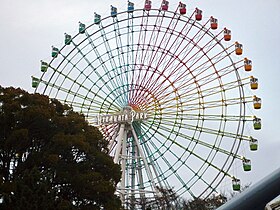
ひらかたパーク
京阪電鉄系の遊園地。愛称は「ひらパー」。
関西でUSJについで入場者数が多い。 毎年秋に開催されていた菊人形展「ひらかた大菊人形」が有名だったが、2005年12月4日をもって96年の歴史に幕を閉じた。2006年以降は従来の規模ではないが、市と協力して菊人形展を継続している。
市の花が菊である事など、枚方市の象徴的な存在として多くの人に親しまれている。
詳しくはひらかたパークを参照。
七夕伝説
枚方から隣接する交野市にかけての一帯には、平安の昔「交野ヶ原」(かたのがはら)と呼ばれていた頃から伝わる七夕伝説がいまに残されている。天の川を間に、別れ別れになった織姫と牽牛が、年に一度、七夕の夜に逢って愛し合うという七夕の話にちなんだ地名や旧跡が存在する。 交野市のゆるキャラ「おりひめちゃん」に対して2012年7月枚方市のゆるキャラ「ひこぼしくん」が産業振興キャラクターとして発表され、日本で初となる2市にわたったペアキャラクターが誕生した。
2011年7月より七夕伝説の街として「星の数ほど出逢いのある街ひらかた」をキャッチフレーズに「ひらコン」という街コンが過去7回開催されている。2013年の7月7日(日曜日)には、日本で初の遊園地での街コン「ひらパーひらコン」を開催し1000名の独身男女の出逢いの場を創出した。
2011年秋より枚方市駅周辺にて「京阪 天の川ウォークバル」が2回開催された。2013年には「京阪 天の川グルメバル」と名称変更し、交野市〜枚方市の広域にかけて開催し、バル総選挙による地域ナンバーワンシェフを選ぶグルメの祭典と進化している。
指定文化財
重要文化財
- 片埜神社本殿(附:棟札)
- 交野天神社本殿(附:棟札)
- 交野天神社末社八幡神社本殿
- 厳島神社末社春日神社本殿
国の特別史跡
- 百済寺跡
史跡
- 5世紀前半頃と考えられている前方後円墳。外堤を含めると北河内最大。
大阪府有形文化財
- 安養寺石造露盤
- 正俊寺石造十三重塔
- 片埜神社東門
- 片埜神社南門
- 田中家住宅鋳物工場
- 田中家住宅主屋
- 釈尊寺木造釈迦如来立像
- 片埜神社石造灯篭
大阪府史跡
- 継体天皇樟葉宮跡伝承地
- 伝王仁墓
- (顕彰規則指定)山田山弥生時代遺跡
大阪府天然記念物

枚方市指定文化財
- 清泰寺木造普賢菩薩座像
- 清泰寺木造文殊菩薩座像
- 廃渚院観音寺鐘楼
- 廃渚院観音寺梵鐘
- 文徳天皇第一皇子惟喬親王の別荘。平安時代。伊勢物語には交野ヶ原へ狩猟に来た時の話が。
- 意賀美神社の算額
- 村野村高札場
- 鍵屋主屋
- 浄念寺木造不動明王立像
- 和田寺木造薬師如来立像
- 大聖寺薬師堂内厨子
- 銅造誕生釈迦仏立像
- 三之宮神社の湯釜
- 鍵屋全体
- 久修園院地球儀
- 久修園院天球儀
- 釈尊寺大般若経
- 御殿山神社遷宮絵馬
- 尊延寺木造不動明王立像
- 尊延寺木造四大明王立像
- 尊延寺木造地蔵菩薩立像
- 交野天神社末社貴船神社本殿
その他
枚方八景
枚方八景とは市制35周年を記念し、市民投票により1984年10月1日に制定された。
愛称道路
- 鏡伝道
- くずはアベニュー
- とうかえでの道
- 松美ケ丘桜通り
- 日置今池街道
- 出屋敷高野街道
- 王仁公園通り
- 山根の道
- 氷室路
- ほたに小径
- 春日通り
- 御殿山アート坂
- 殿山百済寺道
- 中宮平和ロード
- ふれあい通り
- サンシャインロード
- 万年寺山周道
- グリーンバレー通り
- 淀見通り
- 蹉跎参道
- いちょう通り
- けやき通り
出身有名人
芸能・文化人
- 森繁久弥(俳優、枚方市名誉市民、2009年11月没、同年12月に国民栄誉賞)
- 川崎麻世(タレント)
- 岡田准一(アイドル)
- 内藤剛志(俳優)
- もず唱平(作詞家)
- 賀来千香子(女優)
- 五嶋みどり(バイオリニスト)
- ハイヒールリンゴ(漫才師)
- 森脇健児(タレント)
- 坪倉唯子(歌手)
- ミスターちん
- 橘高文彦
- 片渕須直(アニメーション映画監督)
- 橋本さとし
- 田中圭一
- 田丸浩史
- 平井善之(アメリカザリガニ)
- 柳原哲也
- 秋吉英美(タレント・ラジオパーソナリティ)
- 栗山朋子(三重テレビアナウンサー)
- 真戸原直人・阿佐亮介・中原一真(アンダーグラフ)
- 松浦雅也
- 畑中フー
- aki (ZEAL)
- Janne Da Arc(youとshujiは神戸市生まれである。)
- Shinya(Dir en greyのドラム)
- SunSet Swish
- COWCOW
- カラスヤサトシ
- 杉永蘭(ファッションモデル)
- デッカチャン(芸人)
- 相ヶ瀬龍史(俳優)
- 井下好井(芸人)
- 竹村延和(作曲家)
- 山像かおり(声優)
- 森公平(新選組リアン)
- 牧野田彩(AV女優)
- おねだり豊 (芸人)
- 中西正男(芸能リポーター)
- 風藤康二(風藤松原)
- 藤田慧(俳優)
- 田中魁秀(将棋棋士)
- なすなかにし(漫才師)
- 笑福亭福笑(落語家)
- 小笠原茉由(AKB48)
- 谷内伸也(Lead)
- 古川いおり(AV女優)
- アンダーグラフ
- 清水あいり(グラビアアイドル)
- 三代澤康司(朝日放送アナウンサー)
- なきぼくろ(漫画家)
- 辰巳真理恵(ソプラノ歌手)
スポーツ関連人物
- 厚ヶ瀬美姫(プロ野球選手)
- 新井場徹(プロサッカー選手)
- 安藤麻里(プロボクサー)
- 伊藤雄二(元中央競馬調教師)
- 国吉佑樹(プロ野球選手)
- 小﨑まり(陸上競技・中距離走・長距離走・マラソン選手)
- 高橋成忠(元中央競馬調教師)
- 中谷翼(元プロ野球選手)
- 火野裕士(プロレスラー)
- ヒカル・ナカムラ
- 本並健治(サッカー選手)
- 吉永幸一郎(元プロ野球選手)
- 武藤幸司(元プロ野球選手)
- 石田隆司(元プロ野球選手)
- 田中祐樹(プロレスラー)
- 林日向子(バレーボール選手)
- 福村貴幸(プロサッカー選手)
- 武田洋平(プロサッカー選手)
その他
ゆかりのある人物
- 浅田彰(思想家。楠葉地区在住歴あり(『構造と力』初版本著者紹介欄による))
- 伊藤たかみ(小説家。5歳から11歳まで在住)
- 上原浩治(プロ野球選手。高校は市内の東海大仰星高校。浪人時代は同じく市内のKEC近畿予備校に通っていた。)
- 岡本茉利(声優。幼少期に枚方に転居し、同地で中学卒業頃まで生活をしていた)
- ダニエル・カール(山形弁研究家。市内の関西外国語大学に4ヶ月間の留学経験がある)
- 亀山努(元プロ野球選手。1999年に枚方リトルを世界一チームにした功績あり。市内在住中)
- 木村政雄(元吉本興業社員)
- キンタロー。(お笑い芸人。関西外国語大学短期大学部卒業)
- 倉木麻衣(歌手。高校・大学ともに京都市内に通っていたが枚方市に在住し通学していた。)
- ジェロ(歌手。市内の関西外国語大学に3ヶ月間の留学経験がある)
- 辛坊治郎(ニュースキャスター。樟葉在住)
- 瀬藤光利(生命科学者。楠葉地区在住歴あり)
- 辰巳琢郎(俳優。地元在住の女性と結婚後、1男1女を出産し、育児期の約10年間、市内に在住していた)
- 田中和将 (ロックバンド、GRAPEVINEのボーカル、ギター。バンドを結成する以前の少年時代は枚方に住んでおり、楠葉西中学校出身でもある)
- 中西悠子(競泳選手)枚方スイミングスクールコーチ・アテネオリンピック競泳女子200mバタフライ銅メダル
- 藤田まこと(俳優。光善寺地区にごくわずかの期間在住していた)
- 細川益男(実業家、馬主。市内の企業、ホソカワミクロンの代表)
- ますだおかだ(お笑い芸人。市内の関西外国語大学短期大学部在学中に知り合う)
- ミサイルマン (お笑いコンビ)の西代洋は枚方スイミングスクール在籍歴があり、中西悠子と練習をしていたこともあった。
- 山路秀則(実業家、馬主。市内の企業、ヤマジの代表)
- リー5世(お笑い芸人。氷室に在住)
脚注
- ^ 枚方市・交野市・京都府八幡市の汚水を終末処理する下水処理場。窒素リンを除去する高度処理がほどこされ、処理された水の一部は京阪枚方市駅周辺の「せせらぎ水路」、駅のトイレの用水・枚方市役所周辺の緑地への散水、ラポールひらかたの空調の熱源やトイレ用水として再利用されている
- ^
"枚方店の収支はトントンであったが、95年の阪神大震災で大阪店が打撃をこうむり、関西地区は梅田出店構想を前に2005年に大阪地区から一旦撤退を判断"
—大西 洋、『まちづくりにあたって百貨店が果たすべき役割と方向性』、2013年3月29日 http://www.meti.go.jp/committee/sankoushin/shigaichi/pdf/004_04_00.pdf - ^ 1980年版から酒造業の記載無し
- ^ 1986年版から酒造業の記載無し
- ^ 1994年版から敷地内に賃貸アパートが記載
- ^ 1996年版は「津田ショッピングセンター(仮)」が記載。同地が平和堂 アル・プラザ枚方として開業後は、酒販店「みや鶴」として出店
- ^ 廃校になった村野小学校の校舎を利用して、スポーツサークル活動・リサイクル工房・子育て支援広場・図書館などに利用。出典:京阪電気鉄道駅置き情報誌『K PRESS』2011年7月号6面「気になるあの駅散策マップ」より
関連項目
参考文献
- ^ 狂言「禁野」
- ^ 現在の枚方元町・枚方上之町。天野太郎「淀川中流域における寺内町の展開 -枚方寺内町プランの復元を中心として-」足利健亮先生追悼論文集編纂委員会『地図と歴史空間―足利健亮先生追悼論文集』 大明堂、2000年。福島克彦「戦国期寺内町の空間構造」貝塚寺内町歴史研究会『寺内町研究』第10号、2005年。
- ^ a b 大阪府議会ホームページ - 議員定数について
- ^ a b c 枚方市、『枚方市史5巻』、1984年3月31日
- ^ 河内そうめん 私たちが継ぐ 地元夫婦が奮起 - 読売新聞2013年2月26日
- ^ 市立枚方宿鍵屋資料館 くらわんか五六市・大広間茶屋 - 関西文化.com
- ^ 吉田地図 精密住宅地図 枚方市(南部)
- ^ 枚方最後の造り酒屋、穂谷の「重村酒造醸」が3月末で廃業してた - 枚方つーしん2012年4月2日
- 枚方市 『郷土枚方の歴史』 枚方市、1997年、322頁
外部リンク
This article is taken from the Japanese Wikipedia Hirakata-shi
This article is distributed by cc-by-sa or GFDL license in accordance with the provisions of Wikipedia.
In addition, Tranpedia is simply not responsible for any show is only by translating the writings of foreign licenses that are compatible with CC-BY-SA license information.
0 개의 댓글:
댓글 쓰기