Togauchi-cho
| Togauchi-cho | |
|---|---|
| Abolition day | October 1, 2004 |
| Abolition reason | New merger Togauchi-cho + Kake-cho + Tsutsugason → Akiota-cho |
| The current local government | Akiota-cho |
| Data at the time of the abolition | |
| Country | |
| District | The Chugoku district, the Sanyo district The Chugoku, Shikoku district |
| The metropolis and districts | Hiroshima |
| County | Yamagata-gun |
| Group cord | 34,363-3 |
| Area | 192.09km² |
| Total population | 3,204 people (March 31, 2004) |
| The adjacent local government | Kakecho, Yamagata-gun, Geihokucho, Yamagata-gun, Tsutsugason, Yamagata-gun, Toyohiracho, Yamagata-gun, Yoshiwamura, Saeki-gun, Hikimicho, Mino-gun, Shimane |
| Tree of town | Maple |
| The queen of the town | Hydrangea |
| Togauchi-cho government office | |
| The location | 〒731-3810 784-1, Togochi, Akiota-cho, Yamagata-gun, Hiroshima |
| Outside link | Akiota-cho HP |
| Important Notice | The data of the town office are things of the Akiota-cho government office. |
| Wiki project | |

Togauchi-cho (house butterfly) is the town which ever existed in Yamagata-gun, Hiroshima. I became extinct with merging with Kakecho, Yamagata-gun that was adjacent on October 1, 2004 and Tsutsugason equally, and having shifted to Akiota-cho, Yamagata-gun.
Table of contents
History
- The April 1, 1889 - cities, towns and villages system enforcement. There was Togauchi-mura to town level at the time with upper Tonomura who belonged all to Yamagata-gun.
- - Togauchi-mura enforces town organization on August 1, 1933, and Togauchi-cho (the first generation) is established.
- - Togauchi-cho (the first generation) and upper Tonomura merge equally on September 1, 1956, and Togauchi-cho (two generations) is established.
- Both - Kake, Togauchi towns and Tsutsugason merge equally on October 1, 2004 and shift to Akiota-cho and become extinct.
Each generation mayor
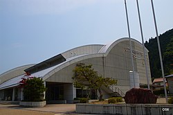
Main facilities
Geography
- River
- Otagawa
- Takiyama River
- Brushwood river
- Mountain
- Mt. fear Rakan (1,346.4m above sea level)…The Hiroshima highest peak.
- Mt. every direction (1,328m above sea level)
- Maruko head (1,236.3m above sea level)
- Mt. whetstone volost (1,177.0m above sea level)
- 深入山 (1,152.7m above sea level)
- Saint mountain (1,113.2m above sea level)
- City Mayama (1,108.5m above sea level)
- Inner Kuroyama (1,082m above sea level)
- 向真入山 (996.2m above sea level)
- Nakayama (970.3m above sea level)
- Nabeyama (871.0m above sea level)
- Eastern Orthodox Church mountain (817.2m above sea level)
Famous place, historic site
- Sandan-kyo Gorge
- Fear Rakan skiing area
- Ikoinomura Hiro Island
- 深入山 green shower
- White valley Matsubara skiing area
- A roadside station next dream and house
- Tateiwa dam
- Waterfall glen
- King night dam
Industrial
Larger section of a village
- The larger section of a village was not organized, but the following subsection existed.
- Azodani (あぞうだに)
- Board ヶ valley (いたがたに)
- Inoshiyama (I stop being, and expanding)
- Uchinashi (there is no depression)
- Kajinoki (the rudder come)
- Upper Tabuki (I change it after かみたぶき )→ Akiota-cho establishment in Tabuki.
- Kamihongo (when there is かみほんごう )→ Togauchi-cho government office. I change it after Akiota-cho establishment in Togauchi.
- Kawate (かわて)
- Scutellum (I released it)
- Sainakae (I change it after さいなかえ )→ Akiota-cho establishment in the glebe.
- Lower Tabuki (I change it after しもたぶき )→ Akiota-cho establishment in Tabuki.
- Shimohongo (I change it after しもほんごう )→ Akiota-cho establishment in Togauchi.
- Glebe (じりょう)
- Brushwood (しわぎ)
- The center (I switch to top after center )→ Akiota-cho establishment.
- Doi (get out)
- Nagata (I switch to top after ながた )→ Akiota-cho establishment.
- Nagahara (I change it after ながばら )→ Akiota-cho establishment in the glebe.
- Nasu (eggplant)
- Hiramitani (ひらみだに)
- Matsubara (rose to wait for)
- Minosumi (I see it and expand I see it and switch to top after )→ Akiota-cho establishment.
- Yoichino (I change it after Ichino )→ Akiota-cho establishment in the glebe.
- Yokokawa (let's row it)
- Yoshiwago (よしわごう)
Traffic (data at the time of September 30, 2004)
Railroad
- There was not it at all in the town, but JR Kabe Line went along the town at the time of a merger until November 30, 2003 approximately one year before the merger. The facilities which were in the town are as follows.
- Top station (I enter the Tsutsugason area once after this)
- Doi Station
- Togauchi Station
- Sandan-kyo Gorge Station…A terminal. Imafuku line included a plan to extend to JR San'in Main Line Hamada Station after this, but was given up without being hardly built.
※I refer to the abolition between the Kabe Line # Kabe Station - Sandan-kyo Gorge station.
Road
- Expressway
- Chugoku Expressway goes, and there are the following facilities in the town.
- National highway
- National highway No. 186
- National highway No. 191
- National highway No. 434…The town gives you an important post with all section National highway No. 186.
- General prefectural road
- Hiroshima prefectural road 249 Sandan-kyo Gorge Line
- Hiroshima prefectural road 252 fear Rakan Park line
- Hiroshima prefectural road 296 Yoshikazu Togauchi Line
- Hiroshima prefectural road 304 Nakatsutsuga underline
- Hiroshima prefectural road 305 Sarasvati Kake Line
- Hiroshima prefectural road 306 Ohara Inoshiyama Line
Education (data at the time of September 30, 2004)
- Elementary school
- Togauchi municipality Inoshiyama Elementary School
- Togauchi-cho setup Elementary School
- Togauchi municipality glebe Elementary School
- Tachido, Togauchi-cho Kochi Elementary School
- Togauchi municipality Matsubara Elementary School
- Junior high school
- Tachido, Togauchi-cho Kochi Junior High School
Remarks
Allied item
This article is taken from the Japanese Wikipedia Togauchi-cho
This article is distributed by cc-by-sa or GFDL license in accordance with the provisions of Wikipedia.
In addition, Tranpedia is simply not responsible for any show is only by translating the writings of foreign licenses that are compatible with CC-BY-SA license information.
0 개의 댓글:
댓글 쓰기