ラビーコ
| ラビーコ Labico | |
|---|---|
| Administration | |
| Country | |
| State | |
| Prefecture | |
| CAP (zip code) | 00030 |
| Area code | 06 |
| ISTAT cord | 058049 |
| Identification cord | E392 |
| Separation village | Colle Spina |
| It is adjacency co-Mu | It is Pare strike Lena, Val mon toe |
| Climate classification | zona D, 1791 GG |
| Official site | Link |
| Population | |
| Population | 6,242 [1] people (2014-01-01) |
| Population density | 339 /km2 |
| Culture | |
| Name of inhabitants | labicani |
| Patron saint | S. Rocco |
| Holiday | August 16 |
| Geography | |
| Coordinate | 41°47'0" N 12°53'0" E / 41.78333 degrees N 12.88333 degrees E coordinate: 41°47'0" N 12°53'0" E / 41.78333 degrees N 12.88333 degrees E |
| Altitude | It is m 319 (280-403) [2] |
| Area | 11.79 [3] km2 |
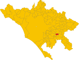 Domain of コムーネ in the Rome prefecture | |

ラビーコ (Italian: Labico) the basic local government (コムーネ ). in the Republic of Italy Lazio Rome prefecture The population is approximately 6,200 people.
Table of contents
Geography
Position, expanse
It is co-Mu of the eastern part of Rome prefecture.
Adjacent コムーネ
Adjacent コムーネ is as follows.
Footnote
- ^ Kunitachi statistics research institute (ISTAT). "Total Resident Population on 1st January 2014 by sex and marital status" (English). December 1, 2014 reading.
- ^ Kunitachi statistics research institute (ISTAT). "Tavola: Popolazione residente - Roma (dettaglio loc. abitate) - Censimento 2001." November 23, 2014 reading.
- ^ Kunitachi statistics research institute (ISTAT). "Tavola: Superficie territoriale (Kmq) - Roma (dettaglio comunale) - Censimento 2001." November 23, 2014 reading.
Outside link
This article is taken from the Japanese Wikipedia ラビーコ
This article is distributed by cc-by-sa or GFDL license in accordance with the provisions of Wikipedia.
In addition, Tranpedia is simply not responsible for any show is only by translating the writings of foreign licenses that are compatible with CC-BY-SA license information.
0 개의 댓글:
댓글 쓰기