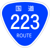
National highway No. 223
| General national highway | |
|---|---|
|
| |
| National highway No. 223 | |
| Route extension | 69.2 km (total extension) 61.7 km (true extension) 61.3 km (the existing way) |
| The establishment year | 1953 designation |
| The starting point | Kobayashi-shi, Miyazaki Azumakamicho intersection (map) |
| Terminal | Kirishima-shi, Kagoshima National highway No. 223 entrance intersection (map) |
| Is connected Main road (Scale) | |
| ■Template (■ notebook ■ how to use )■ Wiki project road | |

National highway No. 223 (223 ごう which how about to release) is a general national highway reaching Kirishima-shi, Kagoshima from Kobayashi-shi, Miyazaki.
Table of contents
Summary
It is repeated with National highway No. 221 to Takaharu-cho by the starting point.
I am called a sightseeing road in the hometown to grow to sew sightseeing spots of foot, Kirishima-jingu Shrine, Kirishima Onsenkyo, Myoken Onsen, Hinatayama Onsen of the Takachiho peak. I was chosen as 100 selections of ways of Japan.
Route data
Origin-destination based on government ordinance [1] [explanatory note 1] appointing the route of the general national highway and the progress grounds are as follows. The terminal in the government ordinance becomes Hayatocho, Aira-gun, Kagoshima, but, with a merger, becomes Kirishima-shi (2005) after November 7 in 2005.
- The starting point: Kobayashi-shi (in Azumakamicho intersection = National highway No. 221 National highway No. 268 point of intersection)
- A terminal: Hayatocho, Aira-gun, Kagoshima [explanatory note 2] (in National highway No. 223 entrance intersection = National highway No. 10 point of intersection, National highway No. 504)
- An important progress ground: MiyazakiNishimorokata-gunTakaharu-cho
- Route extension : 69.2km (true extension 61.7km, existing way 61.3km) [2] [explanatory note 3]
- Between Miyazaki Ward: 28.5km (true extension 21.0km, existing way 20.6km)
- Between Kagoshima Ward: 40.7km
- Designated section : Unavailable [3]
History
- It is May 18 (1953) for 1,953 years
- The enforcement [4] designated as the second grade National highway No. 223 Hayato, Kobayashi flight (Kobayashi-shi - Hayatocho, Aira-gun, Kagoshima [explanatory note 2]).
- It is April 1 (1965) for 1,965 years
- The first class, the second grade division is abolished and appoints it as general National highway No. 223 and takes effect by road law revision [5].
Route situation
Geography

A lot of highlight including Kirishima Onsenkyo is the road of the plateau along around Kirishima, but there is little ups and downs [6]. Known as the good route of the view which the east makes a round trip of it in a forest of the foot of a mountain region of the Takachiho peak which is the highest peak of Kirishima Mountains from Kirishima-jingu Shrine, and Sakurajima can survey during to Kirishima Onsen from Kirishima-jingu Shrine [6].
Local government to pass
Road to intersect
- National highway No. 221 (Kobayashi-shi, Takaharu-cho)
- National highway No. 265 (Kobayashi-shi)
- National highway No. 268 (Kobayashi-shi)
- National highway No. 504 (Hayatocho, Kirishima-shi)
- National highway No. 10 (Hayatocho, Kirishima-shi)
Footnote
Explanatory note
- The notation based on the government ordinance (March 19, 2004 government ordinance 50th) on March 19, 2004 that is a last revision day of the government ordinance appointing the route of the ^ public national highway.
- 1 city and 6 towns merge, and they start Kirishima-shi on ^ a b November 7, 2005.
- As of ^ April 1, 2011
Source
- The ^ "government ordinance (March 29, 1965 government ordinance 58th) which appoints a route of the general national highway." Laws and ordinances data offer system. The Ministry of Internal Affairs and Communications administration Administration Bureau. March 28, 2013 reading.
- ^ "Route distinction of the table 26 public national highway, the road present situation according to the metropolis and districts (PDF)". Road statistics annual report 2012. Ministry of Land, Infrastructure and TransportRoad BureauIt is p. 12. March 28, 2013 reading.
- The ^ "government ordinance (June 2, 1958 government ordinance 164th) which appoints a designated section of the general national highway." Laws and ordinances data offer system. The Ministry of Internal Affairs and Communications administration Administration Bureau. March 28, 2013 reading.
- ^
 There is the original of the government ordinance (May 18, 1953 government ordinance 96th) appointing the route of the the-second-class national highway to the Wiki sauce.
 - Government ordinance (March 29, 1965 government ordinance 58th) which appoints the route of the ^ public national highway
- ^ a b Hidekazu Sudo 2013, pp. 178-179.
References
- Hidekazu Sudo "new Japan 100 way" Oizumi Bookstore, 2013. ISBN 978-4-278-04113-2。
Allied item
Outside link
- Miyazaki prefecture soil Maintenance Division
- Kobayashi engineering works office : I manage the section of Kobayashi-shi - Takaharu-cho, Nishimorokata-gun.
- Miyakonojo engineering works office : I manage the section of Miyakonojo-shi.
- Kagoshima
- Kajiki engineering works office manages the section of other Kirishima-shi a section of 霧島市牧里町 Kurino engineering works office.
This article is taken from the Japanese Wikipedia National highway No. 223
This article is distributed by cc-by-sa or GFDL license in accordance with the provisions of Wikipedia.
In addition, Tranpedia is simply not responsible for any show is only by translating the writings of foreign licenses that are compatible with CC-BY-SA license information.
0 개의 댓글:
댓글 쓰기