Toyama prefectural road 4 Toyama marketing line
| Main country path | |
|---|---|
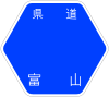 | |
| Toyama Prefectural Road 4 Toyama marketing line | |
| Marketing highway | |
| Route extension | 9.308 km (the true extension sum total) |
| The establishment year | 1955 |
| The starting point | Mukaishinjo Exit intersection (Toyama-shi, Toyama) |
| Important Way city | Toyama-shi, Toyama, Funahashi-mura, Nakaniikawa-gun, Tateyama-machi, Nakaniikawa-gun, Kamiichi-machi, Nakaniikawa-gun |
| Terminal | Mikkaichi intersection (Kamiichi-machi, Nakaniikawa-gun, Toyama) |
| Is connected Main road (Scale) | |
| ■Template (■ notebook ■ how to use )■ Wiki project road | |
The Toyama prefectural road 4 Toyama marketing line (4 ごうとやまかみいちせん which how about which does not lose) is the main country path which links Kamiichi-machi, Nakaniikawa-gun to Toyama-shi, Toyama.
Most sections travel side by side with Toyamachiho Railroad Main Line.
Table of contents
Route summary
- The starting point: 2, Shinjohonmachi, Toyama-shi, Toyama (= National highway No. 41 point of intersection)
- A terminal: Mikkaichi, Kamiichi-machi, Nakaniikawa-gun, Toyama (= Toyama prefectural road 46 marketing Kitababa Line, Toyama prefectural road 3 Toyama Tateyama Uozu Line point of intersection)
I it under an alias
- Marketing highway
Road to intersect
| The road which intersects | The intersection name | |||
|---|---|---|---|---|
| National highway No. 41 Toyama prefectural road 177 Hasumachi Shinjo Line | - | Toyama-shi | Mukaishinjo Exit | |
| Toyama prefectural road 365 Nagaresugi Machibukuro Line | Mukaishinjo | |||
| Toyama prefectural road 338 Joganji offing line | - | Joganji | ||
| Toyama prefectural road 68 Toyama outer fence belt line | - | Development | ||
| - | Toyama prefectural road 68 Toyama outer fence belt line | |||
| Toyama prefectural road 161 Iwakuraji Oishihara Mizuhashi Line | Funahashi-mura | Kunishige | ||
| Toyama prefectural road 159 Takeuchi spring water temple line | Toyama prefectural road 147 Tateyama Funahashi line | Takeuchi | ||
| Toyama prefectural road 15 Tateyama Mizuhashi Line | Funahashi | |||
| - | Toyama prefectural road 163 Izumi Kakizawa line | Kamiichi-machi | Spring | |
| Toyama prefectural road 151 crossroads Namerikawa Line | Syoinshin | |||
| - | Toyama prefectural road 3 Toyama Tateyama Uozu Line | Kamikyoden | ||
| Toyama prefectural road 46 marketing Kitababa Line | Mikkaichi | |||
Overlap section
- Toyama prefectural road 68 Toyama outer fence belt line (Mizuhashiirie, Toyama-shi grounds)
- Toyama prefectural road 3 Toyama Tateyama Uozu Line (Kamikyoden, Kamiichi-machi, Nakaniikawa-gun, Kamikyoden intersection - Mikkaichi, Kamiichi-machi, Nakaniikawa-gun, Mikkaichi intersection, terminal)
along the line
Allied item
This article is taken from the Japanese Wikipedia Toyama prefectural road 4 Toyama marketing line
This article is distributed by cc-by-sa or GFDL license in accordance with the provisions of Wikipedia.
In addition, Tranpedia is simply not responsible for any show is only by translating the writings of foreign licenses that are compatible with CC-BY-SA license information.
0 개의 댓글:
댓글 쓰기