リヒテンベルク (overflanken)
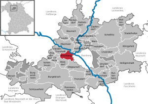
| Crest | Map (position of the ホーフ county) |
|---|---|
 |  |
| Basic information | |
| Federal state: | State of Bayern |
| A precinct: | Overflanken precinct |
| A county: | ホーフ county |
| Latitude longitude: | 50°22'N 11°40'E |
| Altitude: | 564m above see level |
| An area: | 9.47 km² |
| Population: | 1,012 (as of December 31, 2015) [1] |
| Population density: | 107 /km² |
| A zip code: | 95192 |
| An area code: | 09288 |
| A number plate: | HO |
| Local government cord: | 09 4 75 146 |
| The address of the city hall: | Marktplatz 16 95192 Lichtenberg |
| A website: | www.lichtenberg -oberfranken.de |
| The mayor: | ホルガー クニュッペル (Holger Knüppel) |
 | |
リヒテンベルク (Lichtenberg) is the headquarters location of the リヒテンベルク administration community in a city to belong to the State of Federal Republic of Germany Bayern over flanken precinct ホーフ county. This city contacts with リヒテンベルク ruins of a castle.
Table of contents
Geography
Position
リヒテンベルク is located in the mountains Highlands on the ゼルビッツ Valley. This city belongs to the フランケンヴァルト nature park.
Constitution of the local government
Motoichi is official; consisting of eight district (Ort) [2]. Of these, the village except isolated farms is only リヒテンベルク of the principal village.
History

The history of the castle dates back to 814 years. When it was the twelfth century, the Lord of メラニエン built this and was expanded. The town and the castle were performed succession to property of in 1248 by オーラミュンデ 伯. リヒテンベルク appears for the documents for the first time in 1337, and it is proved that I had the city right. The city belonged to the Marquis Brandenburg = Bayreuth choice emperor territory of Hohenzollern from last part of Middle Ages to 1792. リヒテンベルク was in the follower of the Kingdom of Prussia with Marquis Bayreuth choice emperor territory in 1792. In agreement of reconciliation of Tilsit of 1807, the Kingdom of Prussia parted with Marquis Bayreuth choice emperor territory in France. In 1810, the Marquis Bayreuth choice emperor territory including リヒテンベルク finally became the thing of the Bayern kingdom.
Culture and recreation
Music
There is international music education facilities "Haus Marteau" on behalf of overFranken in リヒテンベルク. A master class is carried out throughout the year here.
Middle Ages festival
リヒテンベルク castle lover holds a festival every year in ruins of a castle in the Middle Ages in September.
フランケンヴァルト lake recreation center
フランケンヴァルト lake is in the southern part of リヒテンベルク. The recreation center in the ridge of this lake prepares various vacation facilities. There are swimming spot, bath with the outdoor restaurant and meal, multipurpose hall, campground, Kyukamura.
Population
(the source: the State of Bayern statistics, information Administration Bureau)
Economy and social infrastructure
Local company
- LIROS - Rosenberger Tauwerk GmbH
- Hans Schmidt Kartonagen und Druck GmbH
- Brauerei Sonnenbräu
Honorary citizen
- Henri circle toe (1874-1934), violinist, composer
Footnote
Outside link
(each German)
This article is taken from the Japanese Wikipedia リヒテンベルク (overflanken)
This article is distributed by cc-by-sa or GFDL license in accordance with the provisions of Wikipedia.
In addition, Tranpedia is simply not responsible for any show is only by translating the writings of foreign licenses that are compatible with CC-BY-SA license information.