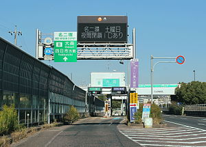
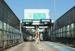
Kashiba interchange
| Kashiba interchange | |
|---|---|
 Sign | |
| Position route | West Meihan Expressway Expressway |
| IC number | 3 |
| Notation of the main line mark | Oji, Kashiba |
| Distance from the starting point | 12.6km (the Matsubara JCT starting point) |
| ◄Kashiba SA (1.1km) (5.4km) Horyu-ji Temple IC► | |
| The general way which is connected | Nara prefectural road 54 Kashiba interchange line |
| The in-service starting date | 1969March 21 |
| Traffic number | x stand / day |
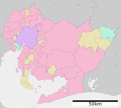
| The location | 〒639-0263 NaraKashiba-shiPlains |
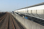
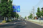
The interchange where the Kashiba interchange (かしば interchange) is on the west Meihan Expressway Expressway of Kashiba-shi, Nara. It is a neighborhood IC of Kashiba-shi and Oji-cho and is East-West extra charges after this IC.
The car that the car flowing in flows out from Kashiba IC with the IC (or a main line tollgate of Kashiwara or Tenri) of the exit in Kashiba IC is an IC of the entrances, and there is not the tollgate to this IC to pay a flat rate (a tollgate was installed in our front IC that adopted a flat rate system once, but was removed in 1981).
Table of contents
Road
- West Meihan Expressway Expressway (the third)
Road to be connected
Neighboring
- JRWakayama LineShizumi Station
- Okuwa Kashiba interchange store
- Yamada-Denki technical center land Kashiba store
- Kashiba City Shizu beauty elementary school
- Distinguished military service sky Imperial mausoleum
- Kashiba-shi government office (Kintetsu Osaka Line Kintetsu-Shimoda Station, around JR Wakayama Line Kashiba Station)
Neighbor
- West Meihan Expressway Expressway
- (2)Kashiwara IC (only in the Matsubara area) - (SA) Kashiba SA - (3) Kashiba IC - (4) Horyu-ji Temple IC
Allied item
Outside link
This article is taken from the Japanese Wikipedia Kashiba interchange
This article is distributed by cc-by-sa or GFDL license in accordance with the provisions of Wikipedia.
In addition, Tranpedia is simply not responsible for any show is only by translating the writings of foreign licenses that are compatible with CC-BY-SA license information.