검색어 , Higashiokitama에 대한 글을 관련성을 기준으로 정렬하여 표시합니다. 날짜순 정렬 모든 글 표시

2016년 10월 31일 월요일

Nakagawa-mura (Higashiokitama-gun, Yamagata)

Nakagawa-mura (Higashiokitama-gun, Yamagata)

Nakagawa-mura
Abolition day 1955June 10
Abolition reason New merger
Akayu-cho, Nakagawa-muraAkayu-cho
The current local government Nanyo-shi, Kaminoyama-shi
Data at the time of the abolition
Country Japanese flag Japan
District The Tohoku district
The metropolis and districts Yamagata
County Higashiokitama-gun
Total population 4,480 people
(national census, 1950)
The adjacent local government Kaminoyama-shi
Akayu-cho, Miyauchi-cho, Takahata-machi
Nakagawa-mura government office
The location Nakagawa-mura, Higashiokitama-gun, Yamagata
 IndicationNotebookEditingHistory Wiki project

The village where Nakagawa-mura (Nakagawa irregularity) was in Higashiokitama-gun, Yamagata. It is at the east end of current Nanyo-shi and is vicinity of Ou Main Line and Nakayama, Kaminoyama-shi.

Table of contents

Geography

  • Mountain : Mount Akiha, high Toyama, Mt. high ツムジ, vast sinus mountain, pan Ishiyama, high Okayama
  • River : Mogami River

History

  • It is started (1889) with Koiwasawa-mura, Kawatoi-mura, Motonakayama-mura, an area of Nakayama-mura on April 1 in 1889 by the enforcement of - municipality organization.
  • It merges with - Akayu-cho (1955) on June 10 in 1955, and Akayu-cho starts some other time. The same day Nakagawa-mura abolition.
  • Some old village level (larger section of a village Nakayama) are admitted into Kaminoyama-shi (1957) in - Akayu-cho on March 21 in 1957.

Traffic

References

Allied item

This article is taken from the Japanese Wikipedia Nakagawa-mura (Higashiokitama-gun, Yamagata)

This article is distributed by cc-by-sa or GFDL license in accordance with the provisions of Wikipedia.

Wikipedia and Tranpedia does not guarantee the accuracy of this document. See our disclaimer for more information.

In addition, Tranpedia is simply not responsible for any show is only by translating the writings of foreign licenses that are compatible with CC-BY-SA license information.

2017년 4월 30일 일요일

Takahata-machi

Takahata-machi

I wait for Takahata
Takahata-machi
Daishoji, Yamagata (Kameoka Bodhisattva of wisdom and intellect) .jpg
Country Japanese flag Japan
District The Tohoku district
The metropolis and districts Yamagata
County Higashiokitama-gun
Group cord 06381-9
Corporation number 1000020063819
Area 180.26 km²
Total population 23,587 people
(population, October 1, 2016 by estimate)
Population density 131 /km²
The adjacent local government Yonezawa-shiKaminoyama-shiNanyo-shi
Nishimachi, Koorigawa, Higashiokitama
MiyagiKatsuta-gunShichikasyuku-machi
Fukushima-shi, Fukushima


Tree of town Akamatsu
(March, 1976 establishment)
The queen of the town Azalea
(March, 1976 establishment)
Takahata-machi government office
The location 992-0392
436, ooaza-Takahata, Takahata-machi, Higashiokitama-gun, Yamagata
38°0'N 9.9 seconds 140°11'E 20.7 seconds
Takahata town office.JPG


Outside link Official site of Takahata-machi

Takahata-machi position figure

- City / - town, village

 IndicationNotebookEditingHistory Wiki project

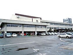
The town of approximately 24,000 population that Yamagata is southeastern in Takahata-machi (I wait for Takahata). I belong to Higashiokitama-gun. I am known as a prosperous town of the agriculture including the best grape 〈 Delaware amount of production in Japan 〉.

Table of contents

Geography

Conditions and facilities of a town

  • Position
    • 140 degrees E 07' - 140 degrees 17′
    • 37 degrees N 54' - 38 degrees 05′
  • Area 
    • 180.26 Square kilometer (March 6, 2015 Geographical Survey Institute)
    • Habitableness place 76.4 square kilometers in area (42.4%)
    • Forests and fields 103.27 square kilometers in area (52.4%)
  • Population: 24,470 (as of April 1, 2015)
    • A man: 11,875 people
    • A woman: 12,595 people
    • The number of the households: 7,520 households
 
Takahata-machi and national age-specific population distribution (2005) Age, men's and women's population distribution (2005) of Takahata-machi
Purple - Takahata-machi
Green - all over Japan
Blue - man
Red - woman
Change of the population of Takahata-machi (area equivalent to)
1970 27,760 people
1975 26,868 people
1980 27,440 people
1985 27,576 people
1990 27,510 people
1995 26,964 people
2000 26,807 people
2005 26,026 people
2010 25,030 people

Ministry of Internal Affairs and CommunicationsStatistics Bureau National censusMore

Administrative

  • The each generation mayor
    • [the first generation] Xinye Kokichi (from November, 1954 to October, 1978)
    • [two generations] Sukezo Shimazu (from October, 1978 to April, 1994)
    • [three generations] Yoshimasa Takanashi (from April, 1994 to April, 2002)
    • [four generations] Akira Watanabe (from April, 2002 to April, 2006)
    • [five generations] Sagae sincerity (as of April, 2006 ...)
  • Takahata-machi assembly
    • 15 member of the Diet fixed number (August, 2015)
  • The budget for town (2015 original budget)
    • * General account 10,890 million yen
    • * Special accounts 6,919,160,000 yen
    • * Corporate accounting 3,829,520,000 yen
    •   21,638,680,000 yen in total
  • The number of the staffs of the town (April, 2015)
    • ○218 members of general office work
    • * 154 hospital personnels

History

  • Before the Meiji Restoration
    • 689 years (Emperor Jitou three years) 国優嗜曇郡 (うきたむのこおり) of the Tadashi Jito Michinoku.
    • 712 years (Wado five years) a country of Dewa 建置 (the Oitama county is subordinate).
    • It is "Yashiro" and specification in one which divides a country of Dewa into 11 counties in an Engi era type (Engi era five years) for 927 years, and did Oitama county of those more for seven minutes.
    • Hiraizumi Fujiwara possesses Michinoku Dewa (Juei era two years) in 1083 and rules this ground for approximately 100 years.
    • Oe becomes Oitama hundreder well Zhuang (whole Oitama) lord of a manor (Kenkyu era three years) in 1192 and rules for 140 years.
    • Masashige Kusuki gives Dewa country Yashiro Zhuang to the Emperor Godaigo (Kenbu era two years) in 1335.
    • 伊達宗遠 defeats Nagai (south morning natural gifts six years) in 1380 and is ruled over Date for 212 years.
    • 移封, Ujisato Gamo govern it to Iwate Yamashiro Masamune Date (Tensho era 19 years) 1591 (seven years).
    • Kagekatsu Uesugi of Echigo is enfeoffed as Aizu (Keicho era three years) in 1598, and Kanetsugu Naoe possesses Date, Nobuo, Yonezawa.
    • It is done 減封, and Kagekatsu Uesugi joins the club after the Battle of Sekigahara (Keicho era five years) in Yonezawa in 1600.
    • It is him, the Shogunate direct control for 1,689 years when in eyes cheap caretakers of the Yashiro volost 30,000 stone (Genroku era two years).
    • The Yashiro volost becomes the governor-general of the Kanto area place of the Uesugis (Kanpo two years) in 1742.
    • 移封, Yashiro volost are divided into two by Takahata, and Oda is governed by Oda and Uesugi (Meiwa four years) in 1767.
    • Oda is 移封 (Tenpo era two years) in Tendo for 1,831 years.
    • A part (14 カ villages) of the Yashiro volost becomes the Shogunate direct control (Meiwa seven years) in 1770 (six years).
    • The Shogunate manages directly (Yasunaga five years) 10 カ villages 1776 (eight years).
    • Kashiwakura encampment handling (four years) (Tenmei era four years) best 1784 10 カ villages.
    • The Yashiro volost becomes the Uesugi rule three times (generous politics three years) in 1791 (76 years).
    • All Yashiro volost becomes the Uesugi territory (1866) in 1866.
    • It is Restoration of the Imperial rule (1867) for 1,867 years.
  • The Meiji period
    • It becomes present Yamagata (1876) in 1867.
    • - Higashiokitama-gun government office is established (1878) in 1879.
    • 6 following villages start by - municipality organization enforcement (1889) in Higashiokitama-gun on April 1 in 1889.
      • Takabata-mura ← Takahata-mura, Akutsu village, Kogooriyama-mura, Takayasu-mura, Izumioka-mura, Shionomori-mura, Hara-mura
      • Niijuku-mura ← Niijuku-mura
      • It is Satomura in Sawamura, Fukanuma-mura, Ipponyanagi-mura, Sanjonome-mura, Kawanuma-mura, Kashiwagime-mura, Ainomori-mura at Yashiro-mura ← bamboo Morimura, Negishi-mura, time
      • Kameoka village ← tortoise Okamura, Tsuyufuji-mura, Iriuda-mura, Funabashi village
      • Wada-mura ← Motowada-mura, Kamiwada-mura, Shimowada-mura, horse-headed demon village, Sazawa-mura
      • Nukanome-mura ← Osonozuka-mura, Kamihirayanagi-mura, faucet village, Natsumo-mura, fortune Sawamura, stone Okamura, Ohashi-mura, Yamasaki-mura
    • - Takabata-mura becomes town organization enforcement, Takabata-cho (1895) on December 12 in 1895.
    • - Takabata-cho becomes changing of a name, Takahata-machi (1905) in January in 1905.
  • The Showa period later
    • - Takahata-machi, Niijuku-mura, Yashiro-mura, tortoise Okamura, Wada-mura become merger, company Gomachi (1954) on October 1 in 1954.
    • - company Gomachi incorporates Nukanome-mura (1955) on April 1 in 1955 and I rename it and become Takahata-machi.
    • I establish the public Takahata Hospital (1955) in 1955.
    • I incorporate a part of - Ohashi district and the Ishioka district into Akayu-cho (1957) on April 1 in 1957.
    • - Takahata-machi business and industry society is born (1960) in April in 1960.
    • 1964 (1964)
      • January - town chapter establishment.
      • Nichiden Takahata mill (のちの Yamagata NEC existing: ASE Japan) which became the pioneer of the company invitation in - Yamagata in June Co., Ltd. establishes it [1].
    • 1967 (1967)
      • April - town reserve fire department start. 
      • August - Uetsu flood (amount of disaster 640 million yen).
      • December - firefighting new Government building completion.
    • The government office Government building is completed (1968) in 1968.
    • It is promotion for a townsman honorary in 濱田廣介氏 (1972) 1972.
    • I publish the Takahata history book about the town "first book" (1973) in 1973.
    • It is published the Takahata history book about the town "second volume" (1976) in 1976.
    • 1979 (1979)
      • It is promotion for a townsman honorary in June in Xinye Kokichi.
      • The November Takahata-machi native district museum opening. A townsman charter establishment. 
    • Special elderly nursing home "まほろば Zhuang" is open (1982) for 1,982 years.
    • 1986 (1986)
      • June - まほろばの city park whole line opening to traffic.
      • The October - Takahata history book about the town "second volume" publication.
      • November - town martial arts gymnasium completion.
  • The Heisei period
    • 1992 (1992)
      • July - Yamagata Shinkansen opening of business.
      • September - Takahata-machi sun hall opening (Takahata Station).
    • The archaeology museum opening (1993) prefectural 1993.
    • The town Takahata Junior High School opening of a school who unified 4 junior high schools in the town block (2016) in 2016.

Education

 
Takahata Senior High School
 
Takahata municipality Takahata junior high school under construction. I unified 4 junior high schools in the town block.

High school

Junior high school

Elementary school

Nursery school

  • Takahata-machi government office Yashiro child building
  • Takahata-machi government office Niijuku nursery school
  • Takahata-machi government office Wada nursery school
  • Horsetail nursery school
  • Good friend nursery school
  • Takahata child garden
  • Mie Takahata society

Economic

Industrial

  • Industrial population
    • The number of the agriculturalists: 5,843 people
    • The number of the industrial workers: 4,117 people
    • The number of the commercial workers: 1,519 people
  • Special product of the town
    • Rice, la France, cherry, apple, grape, matsutake mushroom, beef, carp, refined sake, wine, milk cake, side, natto, dairy products, farm output artefact (juice, jam, dressing, pickle)
    • Takahata つや princess (Takahata brand promotion meeting)

I the head office and a main company, group to be based in in Takahata-machi

  • Takahata-machi product meeting
    • TAKAHATA WINE Co., Ltd.
    • U.S. crane brewing Co., Ltd.
    • Kotaro Goto brewing
    • (資) Goto brewing shop
    • (stock) Saison factory
    • (stock) Takahata farm
    • 三弘製薬 Processed Foods Division Yamagata factory Co., Ltd.
    • (stock) Three depths shop
    • Miwa pickle food Co., Ltd.
    • Izawa of a pickle and the closing a bargain side
    • (stock) Miwa foods
    • Milk Co., Ltd. made in Japan
    • ㈲Takahata natto
    • よねおりかんこう center
    • たいようぱん Co., Ltd.
    • (stock) Apple Land
    • (stock) Agribusiness
    • ㈲Takasago shop confectionary
    • Takahata confectionery association


Post office

  • Takahata post office (the collection and delivery station)
  • Middle Wada post office
  • Nukanome post office
  • Kameoka post office
  • Niijuku post office
  • Yashiro post office

Financial institution

 
The Yamagata first credit union head office

Traffic

 
Takahata Station

Airport

Pike

Route bus

Taxi

  • Hayama sightseeing taxi
  • まほろば combination taxi
  • みつわ taxi

Road

High standard highway

National highway

Public road

Famous place, historic site, tourist attraction

  • Country designated cultural assets (historic spot)
  • Prefecture designated cultural assets (historic spot)
    • Old burial mound group in front of spring water
    • Akutsu old burial mound group
    • North eyes old burial mound
    • Source fortune old burial mound
    • Kamoyama cave old burial mound
    • Miso root old burial mound
    • Akutsu old burial mound
    • Toriicho old burial mound
  • Prefecture designated cultural assets (natural monument)
    • Quercus variabilis of Quercus variabilis, the sun of Takemori
    • Small Yuyama vent plant community
  • Prefecture designated cultural assets (building)

   God of War Shamoto, triple tower, court dance and music, Ishidorii

Sacred rites, special event

  • April - rent-a-bicycle opening (sun building)
  • May - Takahata winery spring festival, Akutsu Yawata Shrine spring festival, Hiro uncrowded child festival (the Hirosuke Hamada Memorial)
  • June - roadside station Takahata festival: Cherry fair
  • July - whole country pet memorial service festival (shrine of the dog)
  • August - まほろば kappa festival (station square mall), roadside station Takahata Festival: Welcome back I enshrine oldness and a fair, a green bamboo lantern [2]
  • September - Akutsu Yawata Shinto shrine autumn festival, the Takahata road race and まほろば marathon meet (Takahata-machi government office)
  • The harvest festival of October - Takahata winery autumn, all-Japan 50 kilometer walk Takahata meeting, roadside station Takahata Festival: Autumn harvest festival
  • It blooms in - winter in February and worships you in peony Festival, winter of Takahata [3]

The above-mentioned event is a thing as of 2010.

Native place celebrity

Other

Footnote

[Help]

Note

  1. A 100% subsidiary of ^ Komori Corp.

Source

  1. ^ "history of Yamagata community development first book P 281 sequel to"
  2. ^ http://www.takahata.info/[Broken link]
  3. ^ http://www.takahata.info/winter/index.htm[ broken link]

References

  • History of Yamagata community development making secretariat "history of Yamagata community development first book Yamagata staff training institute sequel to", 1998.

Allied item

Outside link

This article is taken from the Japanese Wikipedia Takahata-machi

This article is distributed by cc-by-sa or GFDL license in accordance with the provisions of Wikipedia.

Wikipedia and Tranpedia does not guarantee the accuracy of this document. See our disclaimer for more information.

In addition, Tranpedia is simply not responsible for any show is only by translating the writings of foreign licenses that are compatible with CC-BY-SA license information.

2017년 4월 14일 금요일

Tohoku Chuo Expressway

Tohoku Chuo Expressway

National highway
General national highway driveway (A')
(paid / for free)

Tohoku Chuo Expressway
National highway No. 13 mark
National highway No. 115 mark

E13 Tohoku Chuo Expressway
Route extension Approximately 268.0km
2017 (2017) as of March: 110.8km
The opening to traffic year 1994HeiseiSix years) -
The starting point Soma-shi (Soma IC)
Important
Way city
Fukushima-shiYonezawa-shiYamagata-shiShinjo-shi
Terminal Yokote-shi (Yokote IC)
Is connected
Main road
Scale

E6 Joban Expressway
E4 Tohoku Expressway
E48 Yamagata Expressway
E46 Akita Expressway


Template ( notebook how to use ) Wiki project road

Tohoku Chuo Expressway (とうほくちゅうおうじどうしゃどう, TOHOKU-CHUO EXPRESSWAY) is an expressway of approximately 268km in total length to connect Soma-shi, Fukushima to Akita Expressway in Yokote-shi, Akita via Fukushima-shi, Yonezawa-shi, Yamagata, Yamagata-shi, Shinjo-shi in the starting point. The abbreviated designation Tohoku Chuo Expressway (とうほくちゅうおうどう, TOHOKU-CHUO EXPWY).

E13 is allotted to the route number by the expressway numbering [1].

Table of contents

Summary

In the road of this section, it was undertaken an enterprise sporadically after (1984) in 1984, but it is expected that it is elaborated a plan by a high standard highway, and Soma - Yokote interval is applied integrally for the first time (1987) as Tohoku center traversing Expressway in 1987 by the cabinet decision of the fourth whole country overall development plan. Industrialization and the start of construction were carried out in each section, but a policy of the Minister of Land, Infrastructure and Transport Akihiro Ohata maintenance is shown by a flow of the revival of the Tohoku district that I did triggered by the Great East Japan Earthquake on July 22, 2011 [2], and the Soma - Fukushima interval where a prospect of the industrialization did not stand for a long time as basic plan section will be maintained afterwards as public National highway No. 115 Fukushima, Soma road. I am going to aim at the completion within ten years about Soma - Soma west interval, Abukuma east - Abukuma interval, 3 sections, approximately 20km between sacred mountain - Fukushima.

I was appointed [3], and all sections would be placed as the section where Showa ... valley which was non-industrialization section till then, Nozoki - Kamiinnai interval, 3 sections between the Shimoinnai - Ogachi Komachi performed "an investigation to push forward an evaluation for a plan stage" in 2013 than investigation section and were undertaken an enterprise each as Kanayama, Shinjo road, Yokobori road in 2015 when, of these, they were accompanied between Showa ... money of valley, Shimoinnai - Ogachi Komachi [4].

In addition, Tohoku Chuo Expressway does not have the rest area where a service station is installed in.

route masterpieces

The route name of the country development main line Expressway is Tohoku Chuo Expressway and is said according to the following tables.

The starting point Main progress ground Terminal
Soma-shi The neighborhood of neighborhood of neighborhood of neighborhood of Fukushima-shi Yonezawa-shi Yamagata-shi Shinjo-shi Yokote-shi

The route name of the government ordinance appointing the route of the national highway is Tohoku Chuo Expressway Soma Obanazawa Line and is said according to the following tables. In addition, there are few points built in this route name, and most are public national highway driveways running side by side with a national highway.

The starting point Important progress ground Terminal
Soma-shi Fukushima-shi Yonezawa-shi Takahata-machi, Higashiokitama-gun, Yamagata Nanyo-shi Kaminoyama-shi Yamagata-shi Tendo-shi Higashine-shi Murayama-shi Obanazawa-shi

including the interchange

  • There is the section that the background color of the IC number column is in an existing opening to traffic section.
    The section that the background color of the facilities column is corresponds to non-opening to traffic section or non-in-service facilities.
  • I show smart interchange (SIC) in background color .
  • The thing without the special mention of the route name is a municipal road.
  • The facilities where ,○ / ● is stopping ,◆ during the use among bus stop (BS). There is no BS in the no mark.
  • The good plan character shows the following items.
    An IC: Interchange, SIC: Smart interchange, JCT: A junction, SA: A service area, PA: Parking area, TB: Main line tollgate, BS: Bus stop, TN: Tunnel
IC
Number
Facilities name The connection route name The starting point
から
km

BS Remarks The location
23 Soma IC Joban Expressway
National highway No. 115
0.0 Fukushima Soma-shi
I am going to be inaugurated the other day in 2018 [8]
1 Soma Yamagami IC National highway No. 115 6.0 Fukushima north JCT area doorway Abukuma way to the east road
2 Soma Tamano IC National highway No. 115 16.7 Soma IC area doorway
Abukuma IC (tentative name) National highway No. 115 21.7 Fukushima north JCT area doorway I am going to be inaugurated in 2017 [8] Date-shi
Holy mountain IC (tentative name) National highway No. 115 33.7 Roadside station sacred mountain (tentative name) [9] [10]
Spring of 2018 Hiraki Station plan
Tamotsu Fukushima initial side IC (tentative name) Prefectural road 4 Tamotsu Fukushima polar axis 41.7 I am going to be inaugurated in 2020 [11]
National highway No. 4 IC (tentative name) National highway No. 4 43.9 I am going to be inaugurated in 2020 [12]
Fukushima north JCT (tentative name) Tohoku Expressway 45.9 - Koori-machi
(overlap section 8.3km) the details refer to "Tohoku Expressway"
Fukushima-shi
21-1 Fukushima JCT Tohoku Expressway - -
Fukushima JCT TB [13] - 50.0 -
7 Ozaso, Fukushima IC Prefectural road 5 Kaminagura Iizaka Date Line 51.0 The kilometer post as of September, 2016 to 50.9KP
- Kurigo TN (tentative name) - - - Is going to be inaugurated 2017 [14]; [15]
Yamagata Yonezawa-shi
Hachimanpara, Yonezawa IC [16] National highway No. 13
Yonezawa center IC [16] Prefectural road 1 Takahata, Yonezawa Line Roadside station よねざわ (tentative name) [17] [18]
Spring of 2018 Hiraki Station plan
Yonezawa north IC National highway No. 121Tateyama bypass 0.0 Yonezawa Nanyo road
- Yonezawa north TB (tentative name) [19] [20] - -
Takahata, Nanyo IC National highway No. 13 (Nanyo bypass)
National highway No. 113Akayu bypass
10.3 Takahata-machi
- Nanyo PA (tentative name) [21] - I am going to offer it open in 2018 [22] Nanyo-shi
Kaminoyama IC (tentative name) National highway No. 13 (Kaminoyama bypass)
National highway No. 458
I am going to be inaugurated in 2018 [23] Kaminoyama-shi
6 Yamagata Kaminoyama IC National highway No. 13 (Yamagata bypass) 0.0
- Yamagata PA (tentative name) [21] - I am going to offer it open in 2018 [22] Yamagata-shi
7 Yamagata center IC Prefectural road 18 Asahi, Yamagata Line 10.4
6 Yamagata JCT Yamagata Expressway 15.5 -
8 Tendo IC Prefectural road 23 Oe, Tendo Line 22.1 Tendo-shi
- Tendo TB (tentative name) [19] [20] - -
9 Higashine IC National highway No. 287 27.1 Higashine-shi
Higashine north IC (tentative name) Prefectural road 25 Sagae Murayama Line
Murayama IC (tentative name) Prefectural road 25 Sagae Murayama Line Murayama-shi
Murayama north IC (tentative name) Prefectural road 381 Oishida, Murayama Line Yamagata JCT area doorway [24]
Prefectural road 36 Jinengo, Shinjo Murayama Line Yokote IC area doorway [24]
Oishida Murayama IC [16] Prefectural road 189 Oishida Tochiuda Line I am going to be inaugurated in 2017 [25]
Obanazawa IC National highway No. 347 Obanazawa-shi
Nokurosawa IC National highway No. 13 (Obanazawa bypass) Yokote IC area doorway
Obanazawa north IC National highway No. 13 Roadside station Obanazawa
Kawarago IC National highway No. 13 Yokote IC area doorway
Funagata IC Prefectural road 56 Funagata, Shinjo Line Funagata-machi
Shinjo IC National highway No. 47Shinjominami bypass
Prefectural road 34 Tozawa, Shinjo Line
Shinjo-shi
Shinjo north IC (tentative name) [26] [27] Prefectural road 308 Magarigawa Shinjo Line Yokote IC area temporary doorway [26]
IC (tentative name) of the Showa era Prefectural road 319 Akasaka Mamurogawa Line
Kanayama south IC (tentative name) Mt. prefectural road 320 Nita Hiraoka line Kaneyama-machi
Kanayama IC (tentative name) National highway No. 344
Yamakita IC (tentative name) National highway No. 13 Yokote IC area temporary doorway
Yamagata JCT area doorway [28]
Outside swamp IC National highway No. 13 Yokote IC area doorway
Nozoki IC (tentative name) National highway No. 13 Yamagata JCT area temporary doorway [29] Mamurogawa-machi
IC (tentative name) in the Upper House National highway No. 13 Yokote IC area temporary doorway
Yamagata JCT area doorway [29]
Akita Yuzawa-shi
IC (tentative name) in the Lower House National highway No. 13 (Yokobori bypass) Yamagata JCT area temporary doorway
Yokote IC area doorway [30]
Ogachi Komachi IC National highway No. 13 (Yokobori bypass)
Sugawa IC Prefectural road 51 Yuzawa Kurikoma Park line
Mitsuseki IC National highway No. 13
- Ambulance emergency leaving road Prefectural road 278 Ogachi Yuzawa Line Yuzawa IC area exit
Emergency conveyance [31] to Ogachi center Hospital
Yuzawa IC National highway No. 398
- Cross TB - - Yokote-shi
Jumonji IC National highway No. 13 (cross bypass)
3 Yokote IC Akita Expressway
National highway No. 13
  • Because it is not the main line, in the Fukushima JCT tollgate interval, the kilometer post which is on the main line is not established, and Fukushima JCT tollgate is installed in the starting point from Fukushima JCT by 50KP.
  • Because the kilometer post of National highway No. 13 is established, the kilometer post from Obanazawa IC and to the north is not clear for the kilometer post of Tohoku Chuo Expressway.

History

  • It is a degree (1984) for 1,984 years: Yokote south bypass (8.6km) undertakes an enterprise [32].
  • It is a degree (1985) for 1,985 years: Yuzawa bypass (9.0km) undertakes an enterprise [32].
  • It is a degree (1986) for 1,986 years: Obanazawa Shinjo road undertakes an enterprise [33].
  • 1987 (1987)
  • 1989 (1989)
    • February 17 : As Tohoku Chuo Expressway Takahata Murayama flight, Takahata-machi - Murayama-shi is appointed in a national highway [37].
    • February 27 : Takahata - Murayama interval becomes the basic plan section [38].
  • 1990 (1990)
    • It is a degree (1990) for 1,990 years: I start the site purchase of the Obanazawa Shinjo road [33].
    • September : City planning between Kaminoyama - Yamagata Ueyama is decided [39].
  • 1991 (1991)
    • It is a degree (1991) for 1,991 years: I start the construction of the Obanazawa Shinjo road [33].
    • July 17 : A Yokote IC ... size bank intersection interval, a great bank intersection ... girl mind intersection interval are inaugurated [40].
    • December 3 : A maintenance plan between Yamagata Kaminoyama - Higashine is decided [38]; [41].
    • December 20 : Fukushima - Yonezawa north interval and Murayama - Obanazawa interval become the basic plan section [38].
      Takahata-machi - Obanazawa-shi is appointed as Tohoku Chuo Expressway Takahata Obanazawa flight as Tohoku Chuo Expressway Fukushima Yonezawa flight each Fukushima-shi - Yonezawa-shi by a national highway [42].
  • It is November 19 (1993) for 1,993 years: An enforcement order between Yamagata Kaminoyama - Higashine is given [38]; [41].
  • It is November 22 (1994) for 1,994 years: Jumonji IC - Yokote IC interval of the Yuzawa Yokote road is inaugurated [40].
  • It is a degree (1995) for 1,995 years: City planning between the Yonezawa - Yonezawa north is decided [43].
  • 1996 (1996)
    • It is a degree (1996) for 1,996 years: Fukushima - Yonezawa interval and city planning between Higashine - Obanazawa are decided [44]; [45].
      主寝坂道路 undertakes an enterprise [46].
    • May : City planning between Takahata, Nanyo - Ueyama is decided [39].
    • December 27 : Fukushima - Yonezawa interval and a maintenance plan between Higashine - Obanazawa are decided [38].
  • 1997 (1997)
    • February 5 : The Yonezawa - Takahata interval of the Yonezawa Nanyo road becomes the basic plan section [38].
      As Tohoku Chuo Expressway Soma Obanazawa flight, Soma-shi - Obanazawa-shi is appointed in a national highway [47].
    • June 26 : Yuzawa IC - Jumonji IC interval of the Yuzawa Yokote road is inaugurated [40].
    • November 21 : Yonezawa north IC - Takahata, Nanyo IC interval of the Yonezawa Nanyo road is inaugurated [38].
  • 1998 (1998)
    • It is a degree (1998) for 1,998 years: Fukushima - Yonezawa interval undertakes an enterprise [44].
    • December 25 : An enforcement order is given between Fukushima - Yonezawa, and a maintenance plan between Yonezawa - Yonezawa north is decided [48].
      A maintenance plan between Takahata, Nanyo - Yamagata Ueyama is decided, and Higashine - Obanazawa interval undertakes an enterprise [38]; [39] [45].
  • 1999 (1999)
    • April 16 : The city planning of the Shinjo north road is decided [49]; [50]
    • November 27 : Dokusawa temporary doorway (existing Kawarago IC) - Shinjo IC interval of the Obanazawa Shinjo road is inaugurated [38].
    • December 24 : A maintenance plan between the Fukushima JCT - Yonezawa IC (existing Hachimanpara, Yonezawa IC) is changed, and Ozaso IC (existing Ozaso, Fukushima IC) is added [48].
  • It is a degree (2000) for 2,000 years: Shinjo north road undertakes an enterprise [50].
    I start construction of 主寝坂道路 [46].
  • It is a degree (2001) for 2,001 years: I start the site purchase between the Fukushima JCT - Yonezawa IC (existing Hachimanpara, Yonezawa IC) [44].
  • It is September 16 (2002) for 2,002 years: Yamagata Kaminoyama IC - Higashine IC interval is inaugurated [38]; [41].
  • 2003 (2003)
    • It is a degree (2003) for 2,003 years: Yonezawa - Yonezawa north interval undertakes an enterprise and becomes the new direct control method [43].
      I start the site purchase of the Shinjo north road [50].
      An in-hospital road undertakes an enterprise [51].

    • March : Poor construction is found out in the Funagata tunnel of the Obanazawa Shinjo road, and one side traffic and full-scale suspension of traffic are repeated between Dokusawa temporary doorway (existing Kawarago IC) - Funagata ICs for repair construction until December of the year.
  • 2004 (2004)
    • It is a degree (2004) for 2,004 years: I start the construction between the Fukushima JCT - Yonezawa IC (existing Hachimanpara, Yonezawa IC) [44].
    • January 30 : An enforcement order appears between Fukushima JCT - Yonezawa ICs (existing Hachimanpara, Yonezawa IC) (1998) on December 25 1998, but is withdrawn, and it is a new direct control method [38]; [48] [52].
    • March 18 : I abolish a tollgate in Yuzawa IC of the Yuzawa Yokote road and transfer it in the Jumonji Main Line tollgate.
    • April : An Abukuma way to the east road undertakes an enterprise [53].
    • July 28 : Mitsuseki IC - Yuzawa IC interval of the Yuzawa Yokote road is inaugurated [40].
  • 2005 (2005)
    • July : Start the construction of the Shinjo north road [50]; [54].
    • November 5 : Holiday doorway (existing outside swamp IC) - Nozoki IC interval is inaugurated in 主寝坂道路 [55].
  • 2006 (2006)
    • It is a degree (2006) for 2,006 years: I start the site purchase between the Soma west IC - Abukuma east IC of the Abukuma way to the east road [53].
      I start the site purchase between the Higashine IC - Obanazawa IC [45].
    • February 7 : Higashine IC - Obanazawa IC interval becomes the new direct control method [56]; [57].
    • March: A valley undertakes an enterprise in Takahata, Nanyo - Yamagata [39].
    • August 5 : Sugawa IC - Mitsuseki IC interval of the Yuzawa Yokote road is inaugurated [40].
    • November 19: Nokurosawa IC - Dokusawa temporary doorway (existing Kawarago IC) interval of the Obanazawa Shinjo road is inaugurated, and it is made an interchange, and Dokusawa temporary doorway becomes Kawarago IC [58].
  • 2007 (2007)
    • It is a degree (2007) for 2,007 years: I start the construction between the Soma west IC - Abukuma east IC of the Abukuma way to the east road [59].
      I start the site purchase between the Yonezawa IC (existing Hachimanpara, Yonezawa IC) - Yonezawa north IC [43].
      I start the construction between the Higashine IC - Obanazawa IC [45].
      I start the site purchase and the construction of the in-hospital road [51].


    • August 6 : Roadside station Obanazawa costs Hiraki Station [60].
    • August 26 : The Ogachi Komachi IC - Sugawa IC interval of the Yuzawa Yokote road is inaugurated, and the whole line is inaugurated Yuzawa Yokote road [40].
    • September 29 : I start the construction between the Higashine IC - Obanazawa IC [61].
  • 2008 (2008)
    • It is a degree (2008) for 2,008 years: I start the construction between the Yonezawa IC (existing Hachimanpara, Yonezawa IC) - Yonezawa north IC [43].
    • March 30 : A holiday doorway (existing outside swamp IC) interval out of Yamakita IC ... of 主寝坂道路 is inaugurated, and it is made an interchange, and a middle holiday doorway becomes outside swamp IC [62].
    • August 1 : The groundbreaking ceremony of the Abukuma way to the east road is held [63].
  • It is March (2009) for 2,009 years: A sacred mountain road undertakes an enterprise [53].
  • 2010 (2010)
    • It is a degree (2010) for 2,010 years: I start the site purchase between the Abukuma IC - sacred mountain IC of the sacred mountain road [53].
    • March: I start the site purchase between the Takahata, Nanyo IC - Yamagata Kaminoyama IC [39].
    • June 28 : Yonezawa north IC - Takahata, Nanyo IC interval, Yamagata Kaminoyama IC - Higashine IC interval, Yuzawa IC - Yokote IC interval become the object section of the expressway charge-free society experiment each [64].
  • 2011 (2011)
    • March 11 : By the 2011 off the Pacific coast of Tohoku Earthquake (the Great East Japan Earthquake), Yonezawa north IC - Takahata, Nanyo IC interval, Yamagata Kaminoyama IC - Higashine IC interval, Yuzawa IC - Yokote IC interval are closed to traffic at one time [65].
    • March 26 : Shinjo IC - Shinjo north IC interval of the Shinjo north road is inaugurated [66].
    • April: I start the construction between the Takahata, Nanyo IC - Yamagata Kaminoyama IC [39].
    • June 20 : Because the government serves restoration, a revival expense of the Great East Japan Earthquake, expressway charge-free society experiment is finished once at 0:00 and is frozen up at one time [67].
      For the purpose of victim support caused by the Great East Japan Earthquake, restoration, a reconstruction aid, measures that it is free in a pike are started for some vehicles each between Yonezawa north IC - Takahata, Nanyo IC interval that is paid section, Yamagata Kaminoyama IC - Higashine IC interval, Yuzawa IC - Yokote IC [68].
    • August 31 : For the purpose of restoration, a reconstruction aid caused by the Great East Japan Earthquake, measures that it is free finish a pike for some vehicles [68].
    • November : The Soma west road of the Fukushima, Soma road and Abukuma east - Abukuma interval undertake an enterprise [53].
    • November 26 : A revival road start of construction expression is held [69].
    • November 30: For the purpose of victim support caused by the Great East Japan Earthquake, measures that is free finish a pike for some vehicles [68]; [70].
    • December 1 : For the purpose of sightseeing promotion caused by the Great East Japan Earthquake, I carry out measures that it is free in (ETC deployment car-limited) such as the common car, light car of Saturdays, Sundays, and holidays [71].
  • 2012 (2012)
    • It is a degree (2012) for 2,012 years: I start the site purchase between the Soma IC - Soma west IC of the Soma west road [53].
      I start the site purchase between the Abukuma east IC - Abukuma IC of the Fukushima, Soma road [53].
      Izumita road undertakes an enterprise [72].

    • March 31 : For the purpose of sightseeing promotion caused by the Great East Japan Earthquake, I finish measures that it is free in (ETC deployment car-limited) such as the common car, light car of Saturdays, Sundays, and holidays [71].
    • April 20 : Ozaso IC (existing Ozaso, Fukushima IC), Yonezawa center IC, Higashine north IC (tentative name), Murayama north IC (tentative name), Oishida, Murayama IC (existing Oishida Murayama IC) connect it each, and they are admitted [73].
    • July 20 : City planning between sacred mountain - Fukushima of the Fukushima, Soma road is decided [74].
    • November 27: I start the construction between the Abukuma IC - sacred mountain IC of the sacred mountain road [75].
  • 2013 (2013)
    • February 9 : I start the construction between the Soma IC - Soma west IC of the Soma west road [76].
    • May 15 : Sacred mountain - Fukushima interval of the Fukushima, Soma road undertakes an enterprise [74].
    • November 16 : I start the construction between the Abukuma east IC - Abukuma IC of the Fukushima, Soma road [77].
  • 2014 (2014)
    • It is a degree (2014) for 2,014 years: I start the site purchase between holy mountain IC - Fukushima north JCT of the Fukushima, Soma road [53].
    • September 21 : I start the construction between the Shinjo north IC - Showa IC of the Izumita road [78].
    • September 28 : I start construction between holy mountain IC - Fukushima north JCT of the Fukushima, Soma road [79].
    • November 16: Obanazawa IC - Nokurosawa IC interval of the Obanazawa Shinjo road is inaugurated [80].
  • 2015 (2015)
    • April 9 : Kanayama, Shinjo road and Yokobori road undertake an enterprise [81].
  • 2016 (2016)
    • September 11 : Fukushima JCT - Ozaso, Fukushima IC interval is inaugurated [82].
    • November 5 : An IC interval in IC - Lower House in the Upper House of the in-hospital road is inaugurated [83].
    • December 26 : In-service due to begin Yonezawa IC (tentative name), Yonezawa center IC (tentative name), a name of Oishida, Murayama IC (tentative name) are decided formally each in Hachimanpara, Yonezawa IC, Yonezawa center IC, Oishida Murayama IC in 2017 [16].
  • 2017 (2017)
    • March 26 : Soma Yamagami IC - Soma Tamano IC interval of the Fukushima, Soma road (Abukuma way to the east road) is inaugurated [8]; [84].

Route situation

Traffic lane, the maximum speed, rate

It becomes 2 provisional traffic lanes with the whole line, but I overtake it in some sections, and a traffic lane is almost installed. In addition, the neighborhood of each main line tollgate becomes 40km/h.

Section Traffic lane
The up and down line = up line + down line
The maximum speed Rate
Soma Yamagami IC - Soma Tamano IC 2 = 1+1 60km/h Free of charge
Fukushima JCT - Fukushima JCT tollgate 2 = 1+1 40km/h Pay
Fukushima JCT tollgate - Ozaso, Fukushima IC 2 = 1+1
(2 provisional traffic lanes)
60km/h Free of charge
Yonezawa north IC - Takahata, Nanyo IC
(Yonezawa Nanyo road)
70km/h Pay
Yamagata Kaminoyama IC - Higashine IC
Obanazawa IC - Shinjo IC
(Obanazawa Shinjo road)
Free of charge
Shinjo IC - Shinjo north IC
(Shinjo north road)
Yamakita - Nozoki Kim
(主寝坂道路)
Ogachi Komachi IC - Yuzawa IC
(Yuzawa Yokote road)
Yuzawa IC - Yokote IC
(Yuzawa Yokote road)
Pay

Main tunnel and bridge

  • The section that a background color is corresponds to non-opening to traffic section. Name of non-opening to traffic section and all the structure tanka with a thing's name in it are tentative names.
Section Structure tanka with a thing's name in it Length
Up line The down line
Soma IC - Soma Yamagami IC Wild Yashiki Bridge 178m
Imada viaduct 785m
Mt. Shiode tunnel 1,801m
Japanese yen edge tunnel 963m
Soma Yamagami IC - Soma Tamano IC 楢這 tunnel 1,492m
荻平 tunnel 1,023m
Pine ヶ bunch tunnel 1,319m
Tamano Tunnel 968m
Abukuma IC - holy mountain IC Shoji edge tunnel 929m
Waist circulation tunnel 889m
Gold valve storehouse tunnel 626m
Treasure direct tunnel 161m
Seven 窪 tunnels 1,404m
Horse Tateyama tunnel 367m
Boundary ノ eyes tunnel 175m
Holy mountain IC - Tamotsu Fukushima initial side IC Kakeda tunnel 421m
Tomizawa tunnel 433m
上保原 tunnel 305m
Tamotsu Fukushima initial side IC - National highway No. 4 IC Abukuma River Bridge 398m
National highway No. 4 IC - Fukushima north JCT Kori viaduct 1,218m
Fukushima JCT - Ozaso, Fukushima IC New eight Tagawa Bridge 70m
Ozaso, Fukushima IC - Hachimanpara, Yonezawa IC Ozaso tunnel 2,089m
Offing root mountain tunnel 919m
New Takahira tunnel 499m
Cedar ノ flat tunnel 217m
Nakano first Bridge 754m
Nakano Tunnel 476m
New elder swamp 1 bridge [85] 76m
New elder swamp 2 bridge [85] 168m
New elder swamp 3 bridge [85] 201m
New elder swamp 4 bridge [85] 113m
Otaki tunnel 353m
Kurigo tunnel 8,972m
Mizukubo first tunnel 384m
Mizukubo second tunnel 243m
Hachimanpara, Yonezawa IC - Yonezawa north IC Ohashi, Yonezawa 448m
Yonezawa north IC - Takahata, Nanyo IC Mogami River Bridge 214m
Takahata viaduct 611m
Takahata, Nanyo IC - Nanyo PA White dragon Ohashi [86] 552m
Akayu tunnel [86] 1,776m
たかつむじやま tunnel [86] [87] 1,052m
Nanyo PA - Kaminoyama IC Large sinus tunnel [86] 998m
Nakayama tunnel [86] 199m
にしごう tunnel [86] 1,361m
Kaminoyama IC - Yamagata Kaminoyama IC Mt. Miyoshi tunnel [86] 2,980.5m
やまがたざおう tunnel [86] [88] 944m
Yamagata JCT - Tendo IC Numerousness and Ohashi 681m 692m
Murayama IC - Murayama north IC Nishigo viaduct 1,014m
Murayama north IC - Oishida Murayama IC Murayama Tunnel 395m
Obanazawa IC - Nokurosawa IC Nokurosawa viaduct 598.3m
Kawarago IC - Funagata IC Funagata tunnel 1,368m
Nakata IC - Nozoki IC 主寝坂 tunnel [89]2,944m
IC in IC - Lower House in the Upper House In-hospital Iwai temple tunnel [83] 1,585m
獅鼻 tunnel [83] 1,100m
IC - Ogachi Komachi IC in the Lower House Tunnel [90] [91]690m
Yuzawa IC -10 characters TB Kaizegawa Bridge 320.5m
Jumonji IC - Yokote IC Yokote IC bridge 38.5m 38.5m

of the tunnel several

  • The section that a background color is corresponds to non-opening to traffic section. All the names of non-opening to traffic section are tentative names.
Section Up line The down line
Soma IC - Soma Yamagami IC 2
Soma Yamagami IC - Soma Tamano IC 4
Soma Tamano IC - Abukuma IC 0
Abukuma IC - holy mountain IC 7
Holy mountain IC - Tamotsu Fukushima initial side IC 3
Tamotsu Fukushima initial side IC - National highway No. 4 IC 0
National highway No. 4 IC - Fukushima north JCT 0
Fukushima JCT - Ozaso, Fukushima IC 0
Ozaso, Fukushima IC - Hachimanpara, Yonezawa IC 9
Hachimanpara, Yonezawa IC - Yonezawa north IC 0
Yonezawa north IC - Takahata, Nanyo IC 0
Takahata, Nanyo IC - Nanyo PA 2
Nanyo PA - Kaminoyama IC 3
Kaminoyama IC - Yamagata Kaminoyama IC 2
Yamagata Kaminoyama IC - Yamagata center IC 0
Yamagata center IC - Yamagata JCT 0
Yamagata JCT - Tendo IC 0
Tendo IC - Higashine IC 0
Higashine IC - Higashine north IC 0
Higashine north IC - Murayama IC 0
Murayama IC - Murayama north IC [92] 0
Murayama north IC [92] - Murayama north IC [93] 1
Murayama north IC [93] - Oishida Murayama IC 0
Oishida Murayama IC - Obanazawa IC 0
Obanazawa IC - Nokurosawa IC 0
Nokurosawa IC - Obanazawa north IC 0
Obanazawa north IC - Kawarago IC 0
Kawarago IC - Funagata IC 1
Funagata IC - Shinjo IC 0
Shinjo IC - Shinjo north IC 0
Shinjo north IC - Showa IC 0
IC - Kanayama south IC of the Showa era 0
Kanayama south IC - Kanayama IC 1
Yamakita IC - Nakata IC 0
Nakata IC - Nozoki IC 1
IC in IC - Lower House in the Upper House 2
IC - Ogachi Komachi IC in the Lower House 1
Ogachi Komachi IC - Sugawa IC 0
Sugawa IC -3 Seki IC 0
Mitsuseki IC - Yuzawa IC 0
Yuzawa IC -10 characters TB 0
Cross TB -10 characters IC 0
Jumonji IC - Yokote IC 0
The total 39
  • Because the section of 2 provisional traffic lane (※ seals is two-way traffic of completion 2 traffic lane), it becomes one tunnel in an up and down line.

Road manager

  • NEXCO East Japan
    • Northeastern branch office
      • Fukushima Administration Office: Fukushima JCT - Fukushima JCT tollgate
      • Yamagata Administration Office: Yonezawa north IC - Takahata, Nanyo IC, Yamagata Kaminoyama IC - Higashine IC
      • Yokote Administration Office: Yuzawa IC - Yokote IC
  • Ministry of Land, Infrastructure and Transport
    • The Tohoku district maintenance station
      • Iwaki national highway office: Soma Yamagami IC - Soma Tamano IC
      • Fukushima river national highway office: Fukushima JCT tollgate - Ozaso, Fukushima IC
      • Yamagata river national highway office: Obanazawa IC - Shinjo north IC, Yamakita IC - Nozoki IC
      • Yuzawa river national highway office: IC in IC - Lower House in the Upper House, Ogachi Komachi IC - Yuzawa IC

Traffic

24 hours traffic (stand) road traffic general survey

Section The Heisei 17(2005) year The Heisei 22(2010) year
Fukushima JCT - Ozaso, Fukushima IC It is non-opening to traffic at the time of an investigation
Yamagata Kaminoyama IC - Yamagata center IC 2,259 10,833
Yamagata center IC - Yamagata JCT 4,653 21,503
Yamagata JCT - Tendo IC 3,697 15,157
Tendo IC - Higashine IC 2,934 11,128

(the source extracts part data than "2010 road traffic general survey" (Ministry of Land, Infrastructure and Transport homepage) and makes it)

Traffic (stand) mean in 2002 on weekdays according to the section [94]

  • Yamagata Kaminoyama IC - Higashine IC: 2,107

Geography

Local government to pass

※I write down non-opening to traffic section in a diagonal character.

Expressway to be connected

Gallery

Footnote

  1. ^ "list of expressway numbering." Ministry of Land, Infrastructure and Transport. February 28, 2017 reading.
  2. The ^ "Minister Ohata interview point." Ministry of Land, Infrastructure and Transport (July 22, 2011). August 4, 2011 reading.
  3. ^ "Business summary of the 2013 Tohoku district maintenance station (PDF)". It is p. the Ministry of Land, Infrastructure and Transport Tohoku district maintenance station 14 (May 16, 2013). March 14, 2016 reading.
  4. ^ "Industrialization decision of the Kanayama, Shinjo road 5.8km expectation! (PDF)". Serve as public information; mountain No. 629. Kaneyama-machi (May 1, 2015). October 19, 2015 reading.
  5. ^ "General National highway No. 115 Fukushima, Soma road". Ministry of Land, Infrastructure and Transport Tohoku district maintenance station Iwaki national highway office. October 18, 2015 reading.
  6. ^ "way of thinking (PDF) of the choice of the new business candidate point." It is p. a Ministry of Land, Infrastructure and Transport Tohoku district maintenance station road part 2 (March 4, 2015). October 22, 2015 reading.
  7. It is Yamagata Shimbun for Ministry of Land, Infrastructure and Transport three persons committee authorization for Akita prefectural border of ^ Tohoku Chuo Expressway, a business candidate on adoption - March 1, 2017
  8. ^ a b c "Opening to traffic target". A revival road, a reconstruction aid road information site. A Ministry of Land, Infrastructure and Transport Tohoku district maintenance station road part. May 17, 2015 reading.
  9. ^ "Is going to open the Date, sacred mountain "roadside station" spring of 18; locally safe Rogation Days". Fukushima Minyu Shimbun-sha newspaper publisher (January 12, 2017). January 20, 2017 reading.
  10. ^ "Hold roadside station construction くわ; Rogation Days safe in sacred mountain". Fukushima Mimpo-sha Corporation (January 12, 2017). January 20, 2017 reading.
  11. ^ "The opening to traffic prospect of a revival road, the reconstruction aid road is settled "approximately 90%" (PDF)". The Ministry of Land, Infrastructure and Transport Tohoku district maintenance station (October 28, 2016). October 28, 2016 reading.
  12. ^ "About the opening to traffic prospect of the Fukushima, Soma road (sacred mountain - Fukushima interval) (PDF)". Ministry of Land, Infrastructure and Transport Tohoku district maintenance station Fukushima river national highway office (June 7, 2016). June 7, 2016 reading.
  13. ^ "publication (PDF) of the extended model designated competitive bidding." East Nippon Expressway Tohoku branch office (September 7, 2015) Co., Ltd. October 19, 2015 reading.
  14. ^ "Tohoku Chuo Expressway (Fukushima - Yonezawa) (PDF)". Ministry of Land, Infrastructure and Transport Tohoku district maintenance station Yamagata river national highway office. October 19, 2015 reading.
  15. ^ "Tohoku Chuo Expressway (the Yonezawa - Yonezawa north) (PDF)". Ministry of Land, Infrastructure and Transport Tohoku district maintenance station Yamagata river national highway office. October 22, 2015 reading.
  16. ^ a b c d "... (PDF) which plans construction progress toward the opening to traffic of ... 2017 about decision of the Tohoku Chuo Expressway (Ozaso, Fukushima IC - Yonezawa north IC, Oishida Murayama IC - Obanazawa IC interval) interchange (IC) name." Ministry of Land, Infrastructure and Transport Tohoku district maintenance station Yamagata river national highway office / Yamagata (December 26, 2016). December 26, 2016 reading.
  17. ^ "Public information よねざわ May 1, 2015 issue (PDF)". It is p. Yonezawa-shi 10 (May 1, 2015). March 16, 2016 reading.
  18. ^ "... which supports "a roadside station" becoming the nucleus of ... district wound life about the choice of the important point "roadside station" chiefly (PDF)". It is p. the Ministry of Land, Infrastructure and Transport Tohoku district maintenance station 10 (January 30, 2015). March 16, 2016 reading.
  19. ^ a b "Public announcement of the procedure start to affect simple open call for participants type competitive bidding (global assessment successful bid method) (PDF)". East Nippon Expressway Tohoku branch office Yamagata construction office (January 30, 2014) Co., Ltd. October 21, 2015 reading.
  20. ^ a b "Tender notice (PDF)". East Nippon Expressway Tohoku branch office Yamagata construction office (August 25, 2015) Co., Ltd. October 21, 2015 reading.
  21. ^ a b "Tohoku Chuo Expressway (Takahata, Nanyo - Yamagata Kaminoyama) [reevaluation] (PDF)". It is p. East Nippon Expressway Co., Ltd. 9 (December 6, 2011). October 20, 2015 reading.
  22. ^ a b "Reporting (East Nippon Expressway Co., Ltd.) about the connection of expressway convenience facilities (PDF)". Incorporated administrative agency Japan Highway possession, liquidation mechanism (August 10, 2015). October 20, 2015 reading.
  23. ^ "Tohoku Chuo Expressway." East Nippon Expressway Co., Ltd. October 20, 2015 reading.
  24. ^ a b "The Tohoku Chuo Expressway (Higashine - Obanazawa interval) construction situation (PDF)". Ministry of Land, Infrastructure and Transport Tohoku district maintenance station Yamagata river national highway office (September 30, 2015). October 22, 2015 reading.
  25. ^ "Tohoku Chuo Expressway (Higashine - Obanazawa) (PDF)". Ministry of Land, Infrastructure and Transport Tohoku district maintenance station Yamagata river national highway office. October 21, 2015 reading.
  26. ^ a b "... Saturday, March 26 opening to traffic ... (PDF) that National highway No. 13 Shinjo north road is inaugurated." It is p. Ministry of Land, Infrastructure and Transport Tohoku district maintenance station Yamagata river national highway office 2 (February 28, 2011). February 23, 2017 reading.
  27. ^ "National highway No. 13 Izumita road (PDF)". Ministry of Land, Infrastructure and Transport Tohoku district maintenance station Yamagata river national highway office. February 24, 2017 reading.
  28. ^ "Tohoku Chuo Expressway (- Kanayama of the Showa era) plan stage evaluation third explanation document" (PDF). It is p. the Ministry of Land, Infrastructure and Transport Tohoku district maintenance station 27 (November 4, 2014). October 22, 2015 reading.
  29. ^ a b "Tohoku Chuo Expressway (Nozoki - Kamiinnai) plan stage evaluation third explanation document" (PDF). It is p. the Ministry of Land, Infrastructure and Transport Tohoku district maintenance station 27 (November 4, 2014). October 22, 2015 reading.
  30. ^ "New business adoption comment on current events value to affect general National highway No. 13 (Tohoku Chuo Expressway) Yokobori road (PDF)". It is p. a Ministry of Land, Infrastructure and Transport Tohoku district maintenance station road part 2 (March 4, 2015). October 23, 2015 reading.
  31. ^ "I manage an ambulance leaving road in Yuzawa Yokote road from August 1 and start.". Ministry of Land, Infrastructure and Transport Tohoku district maintenance station Yuzawa river national highway office (July 21, 2005). October 23, 2015 reading.
  32. ^ a b c "About the opening to traffic between the Yuzawa Yokote road Mitsuseki IC - Yuzawa IC". Ministry of Land, Infrastructure and Transport Tohoku district maintenance station Yuzawa river national highway office (August 26, 2004). March 5, 2016 reading.
  33. ^ a b c "Road business reevaluation public National highway No. 13 Obanazawa Shinjo road (PDF)". It is p. the Ministry of Land, Infrastructure and Transport Tohoku district maintenance station 2 (November 26, 2010). March 5, 2016 reading.
  34. ^ "the fourth whole country overall development plan" (PDF). It is p. Ministry of Land, Infrastructure and Transport 3 (June, 1987). February 14, 2017 reading.
  35. ^ "the fourth whole country overall development plan" (PDF). It is p. Ministry of Land, Infrastructure and Transport 142 (June, 1987). February 14, 2017 reading.
  36. ^ "Law 83rd (昭六二, 9.1)". The House of Representatives. March 14, 2016 reading.
  37. Government ordinance (1989 government ordinance 35th) which revises a part of the government ordinance appointing the route of the ^ national highway
  38. ^ a b c d e f g h i j k "Expressway of Yamagata (PDF)". It is p. Yamagata prefecture soil Maintenance Division road Maintenance Division Highway maintenance promotion room 2 (July, 2015). March 5, 2016 reading.
  39. ^ a b c d e f "Tohoku Chuo Expressway (Takahata, Nanyo - Yamagata Kaminoyama) [reevaluation] (PDF)". It is p. East Nippon Expressway Co., Ltd. 12 (December 16, 2014). March 14, 2016 reading.
  40. ^ a b c d e f "General National highway No. 13 Yuzawa Yokote road (PDF)". It is p. Ministry of Land, Infrastructure and Transport Tohoku district maintenance station Yuzawa river national highway office 3. March 5, 2016 reading.
  41. ^ a b c "Subsequent evaluation (plan) between Tohoku Chuo Expressway Yamagata Kaminoyama - Higashine (PDF)". It is p. East Nippon Expressway Co., Ltd. 3. March 6, 2016 reading.
  42. Government ordinance (1991 government ordinance 376th) which revises a part of the government ordinance appointing the route of the ^ national highway
  43. ^ a b c d "The road business reevaluation Tohoku Chuo Expressway Yonezawa - Yonezawa north (PDF)". It is p. the Ministry of Land, Infrastructure and Transport Tohoku district maintenance station 2 (October 18, 2013). March 5, 2016 reading.
  44. ^ a b c d "Reevaluation result (2015 business continuation point) (PDF)". It is p. Ministry of Land, Infrastructure and Transport Road Bureau national highway, disaster prevention section 1. March 14, 2016 reading.
  45. ^ a b c d "Road business reevaluation Tohoku Chuo Expressway Higashine - Obanazawa (PDF)". It is p. the Ministry of Land, Infrastructure and Transport Tohoku district maintenance station 2 (October 3, 2011). March 14, 2016 reading.
  46. ^ a b "Road business follow-up evaluation public national highway 13 号主寝坂道路 (PDF)". It is p. the Ministry of Land, Infrastructure and Transport Tohoku district maintenance station 2 (January 29, 2013). March 5, 2016 reading.
  47. Government ordinance (1997 government ordinance twelfth) which revises a part of the government ordinance appointing the route of the ^ national highway
  48. ^ a b c "The Tohoku Chuo Expressway Fukushima - Yonezawa north (PDF)". It is p. Ministry of Land, Infrastructure and Transport Tohoku district maintenance station Fukushima river national highway office / Yamagata river national highway office 1. March 4, 2016 reading.
  49. ^ "... Saturday, March 26 opening to traffic ... (PDF) that National highway No. 13 Shinjo north road is inaugurated." It is p. Ministry of Land, Infrastructure and Transport Tohoku district maintenance station Yamagata river national highway office 3 (February 28, 2011). March 5, 2016 reading.
  50. ^ a b c d "General National highway No. 13 Shinjo north road (PDF)". It is p. the Ministry of Land, Infrastructure and Transport Tohoku district maintenance station 1 (July 22, 2009). March 5, 2016 reading.
  51. ^ a b "Road business reevaluation public National highway No. 13 in-hospital road (PDF)". It is p. the Ministry of Land, Infrastructure and Transport Tohoku district maintenance station 2 (October 31, 2014). March 5, 2016 reading.
  52. ^ "Traffic white paper in 2009 for (PDF)". It is p. the Fukushima / Fukushima Police headquarters 16 (September, 2009). March 5, 2016 reading.
  53. ^ a b c d e f g h "General National highway No. 115 Fukushima, Soma road (reconstruction aid road) (PDF)". It is p. Ministry of Land, Infrastructure and Transport Tohoku district maintenance station Fukushima river national highway office / Iwaki national highway office 3-5 (July, 2015). March 4, 2016 reading.
  54. ^ "step of Shinjo-shi." Shinjo-shi. March 5, 2016 reading.
  55. ^ "It is partial opening to traffic ... about the partial opening to traffic of general national highway 13 号主寝坂道路 on ... Saturday, November 5 (PDF)". Ministry of Land, Infrastructure and Transport Tohoku district maintenance station Yamagata river national highway office (October 3, 2005). March 5, 2016 reading.
  56. ^ "The second country development main line Expressway construction meeting explanation document (PDF)". It is p. Ministry of Land, Infrastructure and Transport 1 (February 7, 2006). March 5, 2016 reading.
  57. ^ "The second country development main line Expressway construction meeting explanation document (PDF)". It is p. Ministry of Land, Infrastructure and Transport 13 (February 7, 2006). March 5, 2016 reading.
  58. ^ "It is partial opening to traffic ... about the partial opening to traffic of the general National highway No. 13 Obanazawa Shinjo road on ... Sunday, November 19 (PDF)". Ministry of Land, Infrastructure and Transport Tohoku district maintenance station Yamagata river national highway office (October 20, 2006). March 5, 2016 reading.
  59. ^ "2015 duties summary (PDF)". It is p. Ministry of Land, Infrastructure and Transport Tohoku district maintenance station Iwaki national highway office 45 (July 7, 2015). March 4, 2016 reading.
  60. ^ "guidance of roadside station Obanazawa." Obanazawa-shi. March 9, 2016 reading.
  61. ^ "I start construction of Tohoku Chuo Expressway (Higashine - Obanazawa interval)!". Ministry of Land, Infrastructure and Transport Tohoku district maintenance station Yamagata river national highway office (September 25, 2007). March 5, 2016 reading.
  62. "General National highway No. 13 "主寝坂道路" (extension 4,900m) in the Kaneyama-machi, Mogami-gun, Yamagata material which I advanced is inaugurated Ministry of Land, Infrastructure and Transport Yamagata river national highway office ^ at 3:00 on the afternoon of Sunday, March 30.". Ministry of Land, Infrastructure and Transport Tohoku district maintenance station Yamagata river national highway office (March 13, 2008). March 5, 2016 reading.
  63. ^ "holding the held date and time: Friday, August 1 11:00 ~ of the general National highway No. 115 Abukuma east road" "groundbreaking ceremony." Ministry of Land, Infrastructure and Transport Tohoku district maintenance station Iwaki national highway office (July 4, 2008). March 9, 2016 reading.
  64. ^ "2010 expressway charge-free society experiment (PDF)". It is p. Ministry of Land, Infrastructure and Transport 2-4 (June 15, 2010). March 5, 2016 reading.
  65. ^ "reference materials -2" (PDF). It is p. East Nippon Expressway Tohoku branch office Co., Ltd. 2 (August 11, 2011). March 10, 2016 reading.
  66. ^ "... Saturday, March 26 opening to traffic ... (PDF) that National highway No. 13 Shinjo north road is inaugurated." Ministry of Land, Infrastructure and Transport Tohoku district maintenance station Yamagata river national highway office (February 28, 2011). March 5, 2016 reading.
  67. ^ "the Great East Japan Earthquake an expressway toll based on" (PDF). Ministry of Land, Infrastructure and Transport Road Bureau (June 8, 2011). March 5, 2016 reading.
  68. ^ a b c "About the free measures traffic method of the expressway of the Tohoku district with the Great East Japan Earthquake". East Nippon Expressway / Central Nippon Expressway / West Nippon Expressway / Honshu Shikoku communication Highway Co., Ltd. Co., Ltd. Co., Ltd. Co., Ltd. (June 8, 2011). March 5, 2016 reading.
  69. ^ "... that ... Tohoku Chuo Expressway leads local revival about revival road start of construction-style holding (PDF)". It is p. the Ministry of Land, Infrastructure and Transport Tohoku district maintenance station 1 (November 24, 2011). March 5, 2016 reading.
  70. The plan at the beginning of ^ was until June 19, 2012.
  71. ^ a b "About the handling after free measures December of the expressway of the Tohoku district". East Nippon Expressway / Central Nippon Expressway / West Nippon Expressway / Honshu Shikoku communication Highway Co., Ltd. Co., Ltd. Co., Ltd. Co., Ltd. (November 21, 2011). March 5, 2016 reading.
  72. ^ "Road business follow-up evaluation public national highway 13 号主寝坂道路 (PDF)". It is p. the Ministry of Land, Infrastructure and Transport Tohoku district maintenance station 9 (January 29, 2013). March 5, 2016 reading.
  73. ^ "Six places of interchanges are maintained newly in northeastern jurisdiction (PDF)". The Ministry of Land, Infrastructure and Transport Tohoku district maintenance station (April 20, 2012). May 29, 2013 reading.
  74. ^ a b "National highway No. 115 Fukushima, Soma road (sacred mountain - Fukushima) center stake setting type (PDF)". It is p. Date-shi / Koori-machi / Fukushima / Ministry of Land, Infrastructure and Transport Tohoku district maintenance station Fukushima river national highway office 9 (October 6, 2013). March 9, 2016 reading.
  75. ^ "I hold "the groundbreaking ceremony" of the Fukushima, Soma road (sacred mountain road) (PDF)". It is p. Ministry of Land, Infrastructure and Transport Tohoku district maintenance station Fukushima river national highway office 1 (November 20, 2012). March 5, 2016 reading.
  76. ^ "construction start of construction ... (PDF) first in a new industrialization section (two sections 11km) in - Fukushima held by "the groundbreaking ceremony" of the Fukushima, Soma road in Soma-shi." It is p. Ministry of Land, Infrastructure and Transport Tohoku district maintenance station Iwaki national highway office 1 (February 1, 2013). March 9, 2016 reading.
  77. ^ "I hold "the groundbreaking ceremony" of the Fukushima, Soma road (Abukuma east - Abukuma) (PDF)". It is p. Ministry of Land, Infrastructure and Transport Tohoku district maintenance station Fukushima river national highway office 1 (November 11, 2013). March 5, 2016 reading.
  78. ^ "First step ... to tie to news - Tohoku Chuo Expressway, the north of the National highway No. 13 Izumita road groundbreaking ceremony (PDF)". It is p. Ministry of Land, Infrastructure and Transport Tohoku district maintenance station Yamagata river national highway office 1 (August 27, 2014). March 5, 2016 reading.
  79. ^ "It is construction start ... in the last section of news - Fukushima, Soma road of the Fukushima, Soma road (sacred mountain - Fukushima) "groundbreaking ceremony" (PDF)". It is p. Ministry of Land, Infrastructure and Transport Tohoku district maintenance station Fukushima river national highway office 1 (September 19, 2014). March 5, 2016 reading.
  80. ^ "National highway No. 13 Obanazawa Shinjo road smooth traffic between ... winter season inaugurated on Sunday, November 16, 2014 security ..." (PDF). Ministry of Land, Infrastructure and Transport Tohoku district maintenance station Yamagata river national highway office (October 16, 2014). October 17, 2014 reading.
  81. ^ "Ministry of Land, Infrastructure and Transport distributes Kanayama, Shinjo road into an investigation design for industrialization 5.8 kilos 100 million yen". Yamagata Shimbunsha (April 10, 2015) Co., Ltd. March 5, 2016 reading.
  82. ^ "... (PDF) which contributes to promotion of ... sightseeing, agriculture inaugurated on Tohoku Chuo Expressway (Fukushima - Yonezawa) Fukushima JCT - Ozaso, Fukushima IC room" "Sunday, September 11." Ministry of Land, Infrastructure and Transport Tohoku district maintenance station Fukushima river national highway office / Fukushima / East Nippon Expressway Tohoku branch office Fukushima Administration Office Co., Ltd. (August 10, 2016). August 10, 2016 reading.
  83. ^ a b c "... (PDF) that I evade a traffic obstacle point for ... winter season when National highway No. 13 in-hospital road is inaugurated on Saturday, November 5, and safe, smooth traffic is found." Ministry of Land, Infrastructure and Transport Tohoku district maintenance station Yuzawa river national highway office (September 14, 2016). September 15, 2016 reading.
  84. ^ "opening to traffic 〉 (PDF) first on 〈 Fukushima, Soma road inaugurated on Tohoku Chuo Expressway Abukuma way to the east road Sunday, March 26." Ministry of Land, Infrastructure and Transport Tohoku district maintenance station Iwaki national highway office (January 12, 2017). January 12, 2017 reading.
  85. I put 4 bridges of the ^ a b c d new elder swamp 1 bridge ... new elder swamp 4 bridge together and say with new elder swamp Bridge.
    "The Tohoku Chuo Expressway Fukushima - Yonezawa north (PDF)". It is p. Ministry of Land, Infrastructure and Transport Tohoku district maintenance station Fukushima river national highway office / Yamagata river national highway office 2. November 15, 2015 reading.
  86. ^ a b c d e f g h "I concentrate techniques of the NEXCO East Japan and challenge difficulty construction". Steel structure publication Co., Ltd. December 3, 2015 reading.
  87. ^ "Tender notice (manual) (PDF)". It is p. East Nippon Expressway Tohoku branch office Co., Ltd. 1 (January 22, 2015). December 3, 2015 reading.
  88. ^ "Tender notice (manual) (PDF)". It is p. East Nippon Expressway Tohoku branch office Co., Ltd. 1 (October 17, 2014). December 3, 2015 reading.
  89. It is written down to the ^ signboard with 2,940m.
  90. ^ name undecided
  91. ^ round numbers
  92. The ^ a b south side
  93. The ^ a b north side
  94. ^ 2003 JH annual report

Allied item

Outside link

This article is taken from the Japanese Wikipedia Tohoku Chuo Expressway

This article is distributed by cc-by-sa or GFDL license in accordance with the provisions of Wikipedia.

Wikipedia and Tranpedia does not guarantee the accuracy of this document. See our disclaimer for more information.

In addition, Tranpedia is simply not responsible for any show is only by translating the writings of foreign licenses that are compatible with CC-BY-SA license information.